The first part of this year’s family holiday was a multiday hike! Our target region is Auvergne (France), where we started looking for good hiking paths combinable into a closed loop. My wife Mieke spotted a nice loop: Boucle de Sancy, grouping all the prerequisites: a closed loop, ~60km, marked path, nice views, mostly in nature.
Read on for a picture loaded report.
Skip directly to one of the parts, or read it all:
Mieke made a plan, splitting the hike in 4 sections. She also spotted a possible place to sleep at the end of each section. And we made note of food, and water resupply possibilities. As is often the case in these type of adventures, we did not stick to the plan.
| day | section | distance | EG1 | moving time |
|---|---|---|---|---|
| mon. 22/07 | Cable car - camping de la Grande Cascade | 10.5km | 341m | 04h00 |
| tue. 23/07 | Grand Cascade - camping La Ribeyre | 18.5km | 605m | 06h00 |
| wed. 24/07 | La Ribeyre - bivouac Lac Pavin | 18.0km | 770m | 06h00 |
| thu. 25/07 | Lac Pavin - Cable car | 13.0km | 858m | 05h00 |
We caried about 50kg between us at the start, including snacks for 2 days and water and dryed hiking food for one day (just to be certain).
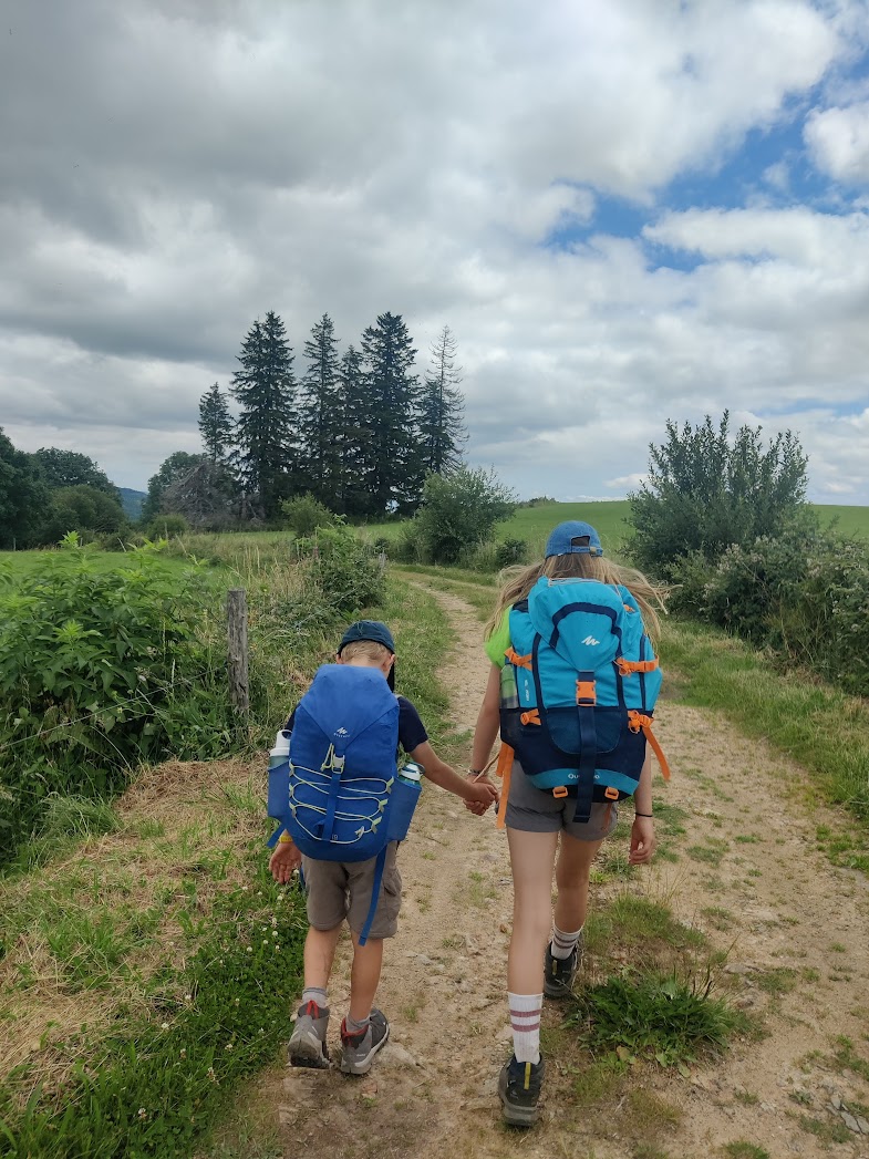
We would do this together: Mieke and I, and 3 of our kids: Pjotr (15yo boy), Hilke (13yo girl) & Siegert (9yo boy).
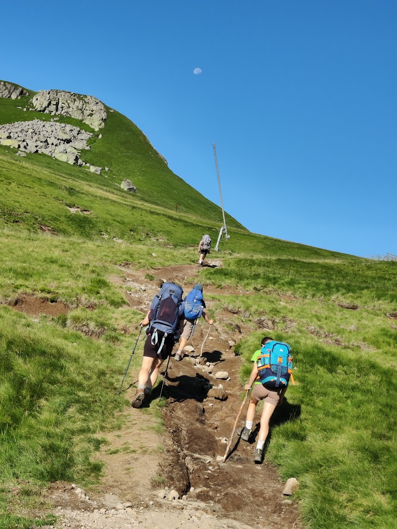
Having left the car in the carpark of the Youth Hostel of Mont Dore, we take the somewhat dated but still working téléphérique (cable car) to the ridge of Puy de Sancy. There we set off in the fog. It had rained the whole evening and night before, but it is dry now. Unfortunately we cannot enjoy much of what should be a spectacular view.
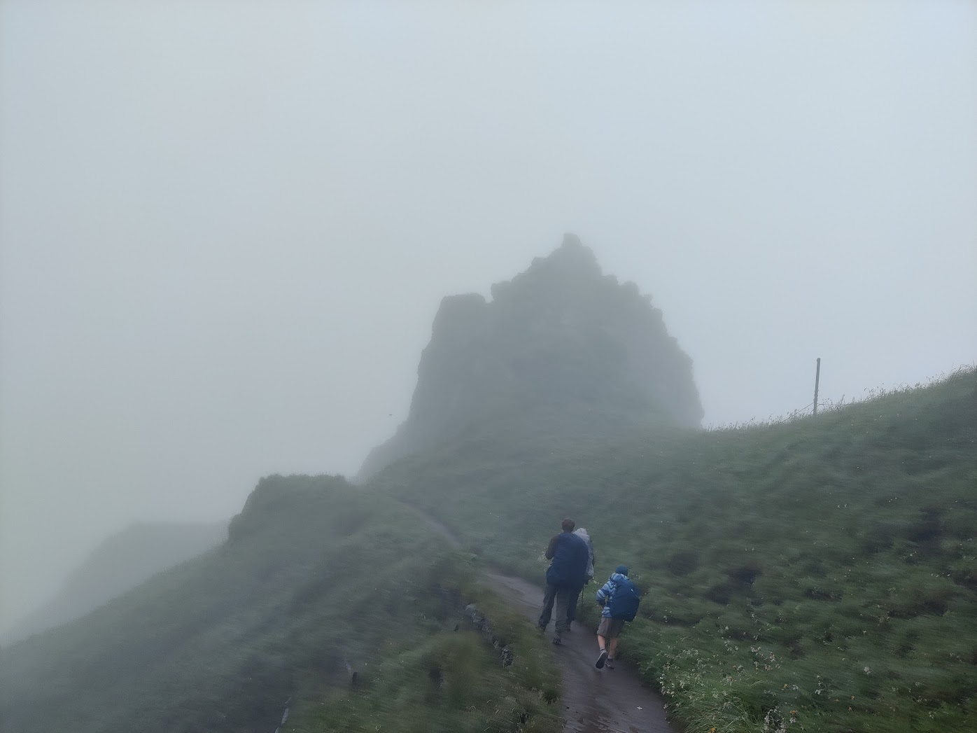
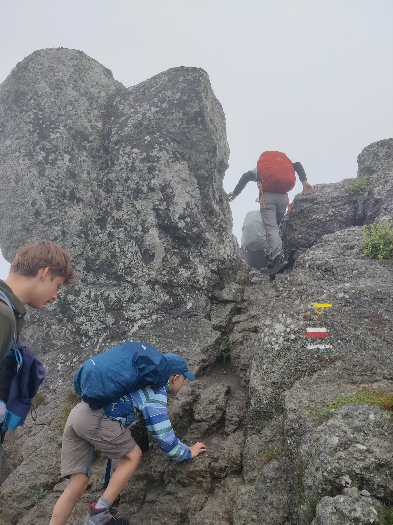
We continue to follow the ridge, mainly downhill, in the direction of the town of Mont Dore. Several parts require some rock scrambling.
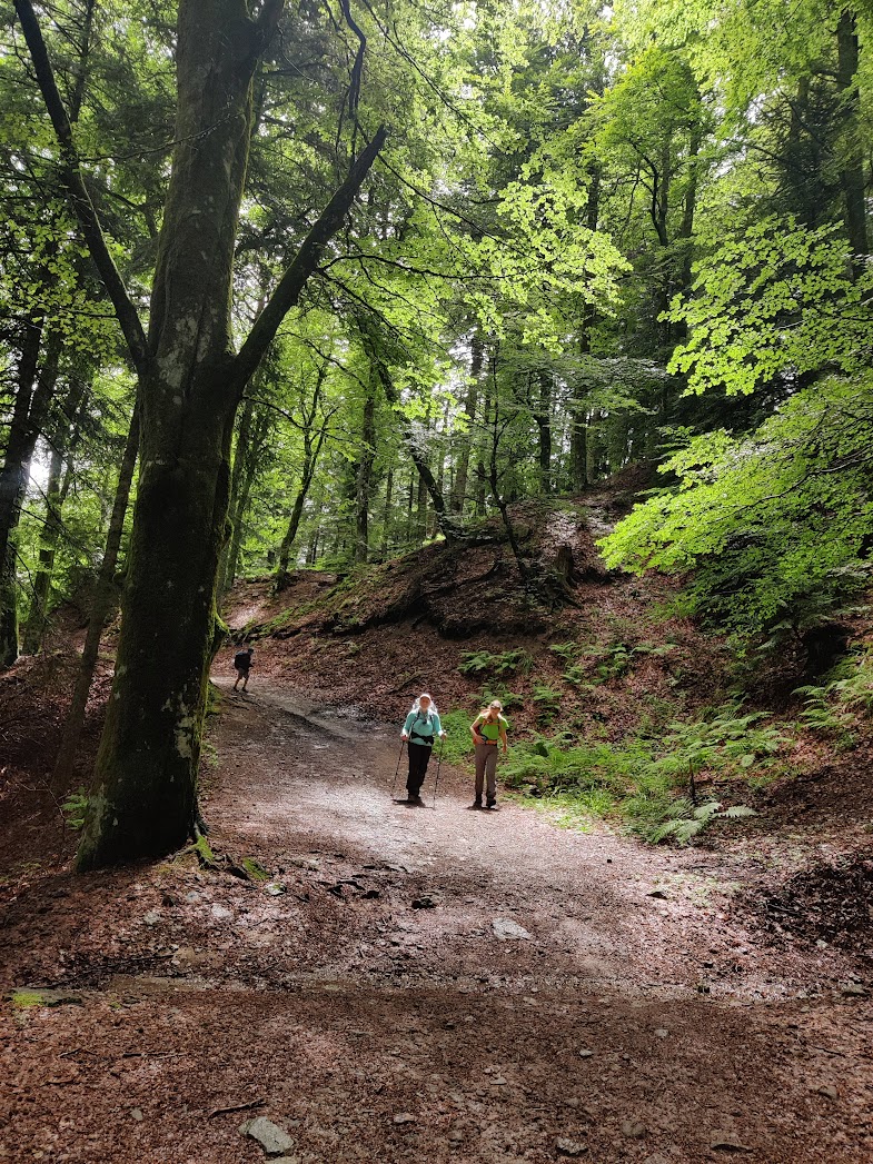
As the day advances, the fog and clouds give way to ever more sunshine. Layers of clothing come off one by one. We are mostly alone on the trail. We meet some trail runners and one or two other hikers. After about 1h30 it’s time for the first snack break. There will be many more of those. We can enjoy views of the hills, with sheep and horses. Further north we spot the forests around Mont Dore. With the sun in the sky, it gets hot quickly and we enjoy the welcome shade provided by the forest.
Through the forest, and then downhill to Mont Dore. On the descent we marvel at an old cable train: le funiculaire du Capucin. The first signs of fatigue are there for the younger kids. We plan to take a longer break in Mont Dore. We have to shop for groceries anyway, so might as well go for a drink in a bar first.
Loaded with enough food for tonight and tomorrow, we leave Mont Dore: a good climb out of the valley upto la Grande Cascade. It’s always good to have a nice landmark as a goal for your next section.
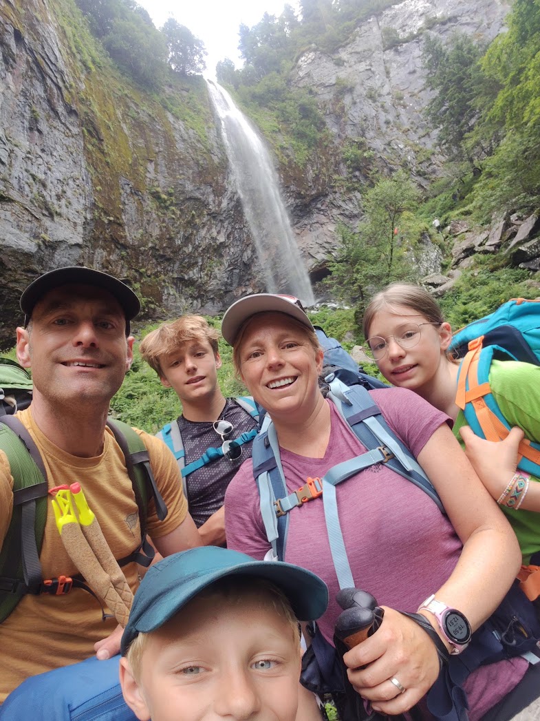
The climb continues after the waterfall: we go up to the ridge. And here we are with a first insight we wanted to pass to our childeren: The nice view you get on the top/ridge is the reward for the hard work you have to do climbing up.
Then the last 2km to the camping spot. The Camping de la Grande Cascade is a nice camping site with spacy pitches. There is also a bar and bread delivery at the camping in the morning. After we pitched our tents, it’s time to relax, taking a drink at the camping bar, letting our feet and backs rest. The first day is behind us. Smiles all around: we made it that far, with more kms than planned. But with enough time left in the day to recharge for tomorrow.
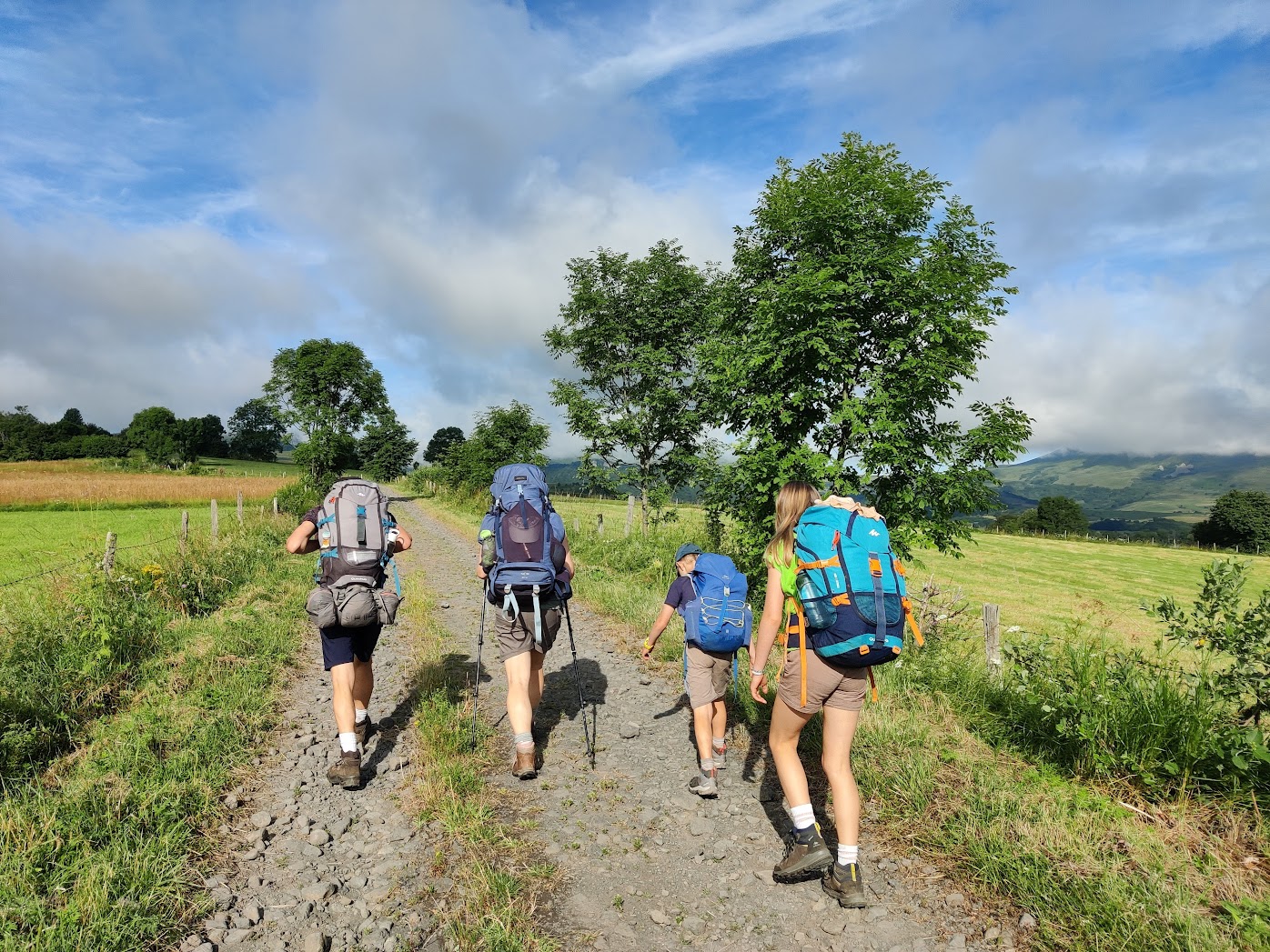
Breakfast on fresh baguettes and then it’s time to pack everything again and set out for the second day. The sun is out, this promises to become a beautiful and hot day.
The plan is to continue along the marked course, first climbing for about 1/3 of the planned distance and then mainly downhill in the direction of Lac de Chambon. We plan to find a pitch in a camping just south of the lake.
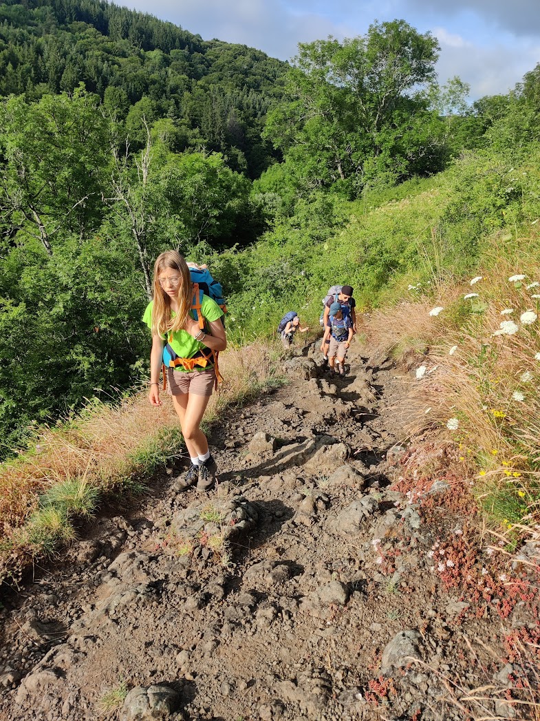
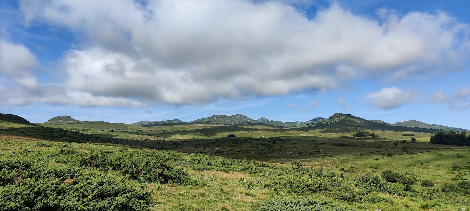
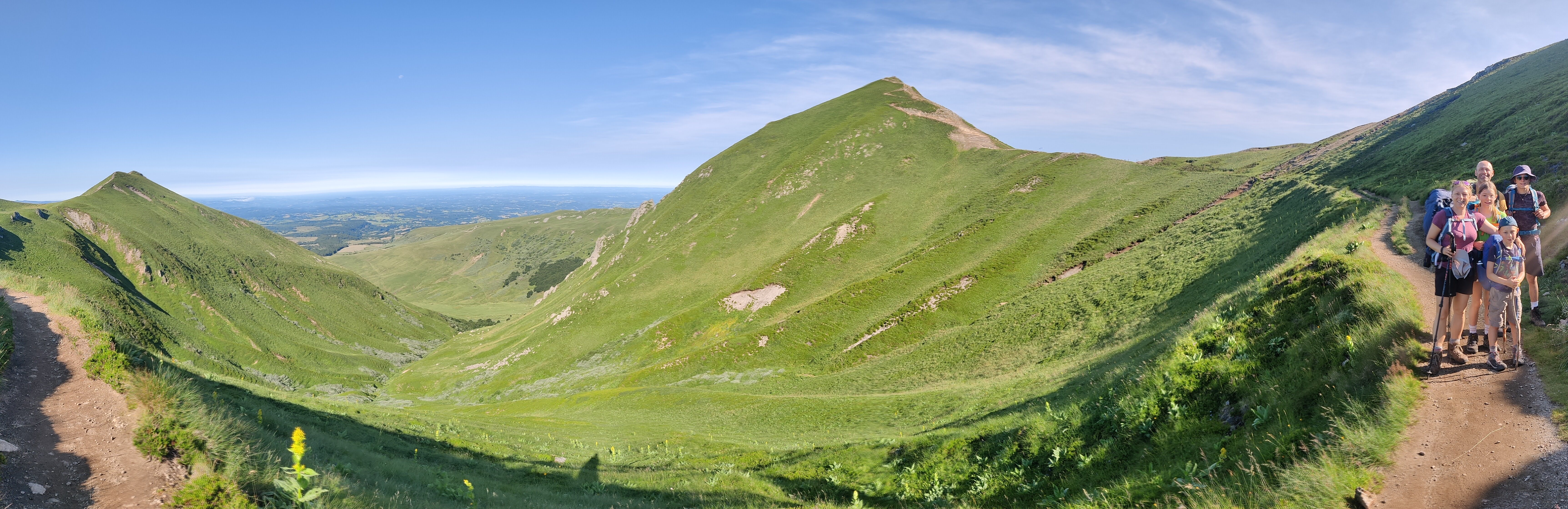
We set out with a beautiful view. This is why we are here.
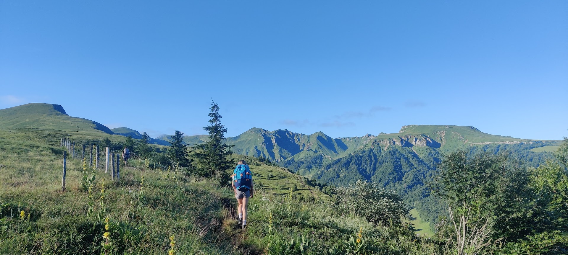
On the left in the picture above you can spot the first of 2 summits we have to scale: Roc de Cuzeau at 1737m. That’s some 500m of EG to start with. Siegert, the youngest one, has a hard time, especially on the last kilometer of this first ascent. His nagging and whining make it a task for us to remain calm. I try to focus on walking and enjoying the surroundings. I try to motivate him positively and don’t respond directly to his whining. We reach the summit and spot the next summit in front of us, at the other side of the pass: Puy des Crebasses at 1762m.
On that second ascent we cross a shepherdess with her flock and dogs: 3 border collies and a big white swiss shepherd.
Siegert is generally afraid of dogs he doesn’t know, especially if they are off leash and come close to him. As these dogs are working, they are off leash. That makes sense. The swiss shepherd comes very close to us (less than half a metre). Siegert is clearly uncomfortable. I take his hand into mine, talk to him and guide him beyond the dog. At that moment the dog starts barking. What doesn’t make sense to me is that the shepherdess didn’t call her swiss shepherd back after Siegert started crying. That wasn’t a positive experience, neither for him nor for the rest of us.
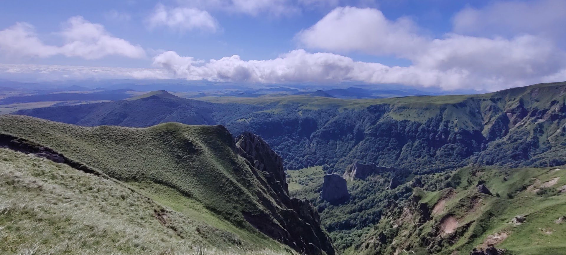
A bit further we reach the summit and turn left to long the ridge down towarde Chambon-sur-Lac, with a beautiful wild valley at our right hand side: la vallée de Chaudefour.
Stretches of grassland alternate with patches of forest with welcome shadow. The going is a bit easier than the first part of the day. Further down the valley we follow a gravel road, where we can easily walk side to side and talk a bit.
We reach the village of Chambon, where we take the time to have a drink on the terrace of the local bar. A well deserved pint of local brewed beer for me. Refreshed, we set out for the last 5km of the day. Mainly flat paths and roads to the lake and then to the camp site.
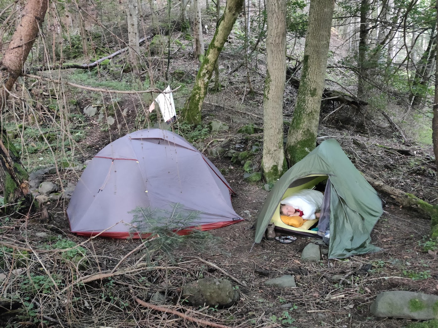
When we arrive at the camp site, it is not what we had expected. It’s a very big and crowded camp site. At the reception they say they are almost completely booked, with only one free pitch: in a corner between the bar and the swimming pool. We realize that this is not what we want. The contrast between the bustle of the crowd and the tranquility of nature we came out of couldn’t have been bigger. I take a look at the map and spot a patch of forest some 2km further on the route. I suggest to the others to continue and to look for a bivouac spot in that forest. After some negotiations, we decide to follow my plan.
Once in the particular forest patch, it takes us some looking around and walking left and right to find a good spot. But finally we succeed: a nice, almost flat, piece of forest. Away from the trail, not on private land and with a small stream nearby.
Mieke, Hilke, and I take a natural bath in the stream to rinse off the sweat of the day. A meal of hamburgers in our bellies and we are ready for the night. A first time bivouac in nature for Hilke and Siegert.
That was a good and quiet night! Woken up by birdsongs and the russle of the stream. Here we go again for another long hiking day. The plan for today is to hike to the crater lake Lac Pavin, where we expect to find a bivouac spot somewhere in the forest surrounding the lake. But first we will have a stopover in Besse to resupply.
The route brings us over single track trails and broader gravel roads. We spot some birds of prey circling over the pastures where farmers are turning the hay. Such majestic birds, but impossible to make good pictures of them with my phone.
It goes up and down and some of the climbs are rather steep. The combination of the sun on our backs, the weight of our packs, and the steep climbs makes us work hard! Fortunately there are patches of forest, sometimes even bigger ones, to offer us some shadow.
And after a climb, there is often the reward of a beautiful view. This really is a nice part of the world. We follow a single track trail between the pastures, lined with wildflowers in a thousand different hues. They are bustling with insects. I enjoy every bit of it.
It seems like we are getting into a certain flow, and that hiking comes a bit easier for everyone.
After 5hrs of hiking, we spot Besse in the bottom of its valley. A last descent, then past an old water mill, over the little bridge and we step into the old town. Besse is a town with a medieval past, to which several buildings bear witness. First things first: we are thirsty, so to flush the dust of the road out of our throats, we look for a café. After that, we leave the kids in a small park and go look for the supermarket to resupply. We picnic in the park and set out again, to Lac Pavin!
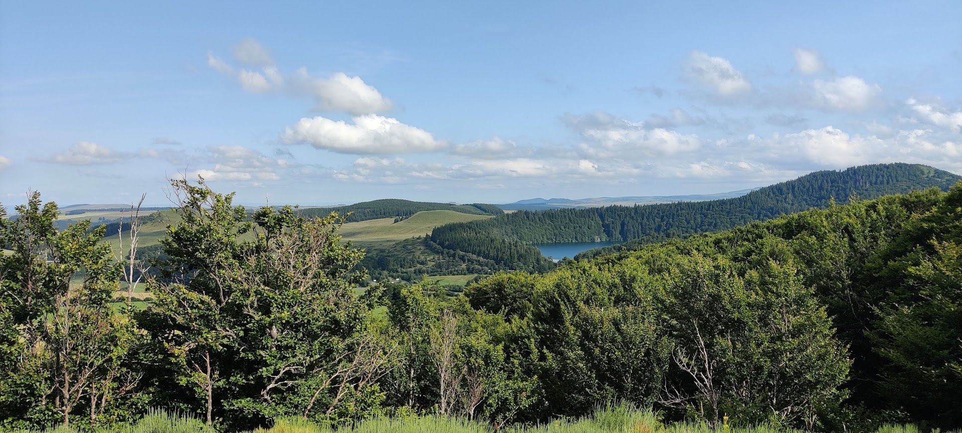
After another 2hrs of hiking, mainly uphill now, we reach the forest surrounding the crater lake. We follow the forest around the lake to the one place where the sides of the crater are low enough to access the water. It is hot, so there are lots of people there.
We rest a bit at the lake side and then I go scouting for a bivouac spot. It takes me some time, and some climbing to find a good spot. I want it to be far enough from that one place with all the people. It has to be relatively flat and roomy enough for our two tents. Upon my return with the rest, Mieke lets me know that she has an alternative idea. She has found an official bivouac place in the ski resort of Super Besse. It’s some 6km further then where we are now, but we all think it will be quieter there. There will certainly be less people.
Some deliberations with the kids and we decide to follow Mieke’s plan. Another good part of that plan is that it will shorten our hike tomorrow with the same 6km. This is a bonus, as we have planned to drive further south to the Ardèche region after our hike: a 3h30 drive.
The route to Super Besse goes mainly uphill again. Sometimes it’s hard, sometimes less so.
Just before arriving in the ski resort, the trail is blocked by a closed fence, too high to scale. So we make a cross country detour. Luckily I have a map. I easily plot a route back to our marked course.
We arrive at the bivouac site: a rectangle area marked by rope on small wooden poles. There are some other hikers. After pitching our tents, I go over and talk a bit to some others.
We are all tired from the long day’s hike. So soon after our meal, we hit the sack for a good night rest. Unfortunately, the other hikers on the area don’t seem very tired. I have to get out of our tent and go ask them to be more quiet please, so we can sleep. Which they do.
The last part of our trip is ahead of us: less than 6km remains. It’s all uphill from here, with the ascent to Puy de Sancy (1885m) at the end as the culmination of our adventure. We fill our packs for the last time and start climbing.
The sun is out and even if we started walking early on, it’s getting hot fast. A short stopover to apply sunscreen when we get out of the forest and onto the alpine pastures.
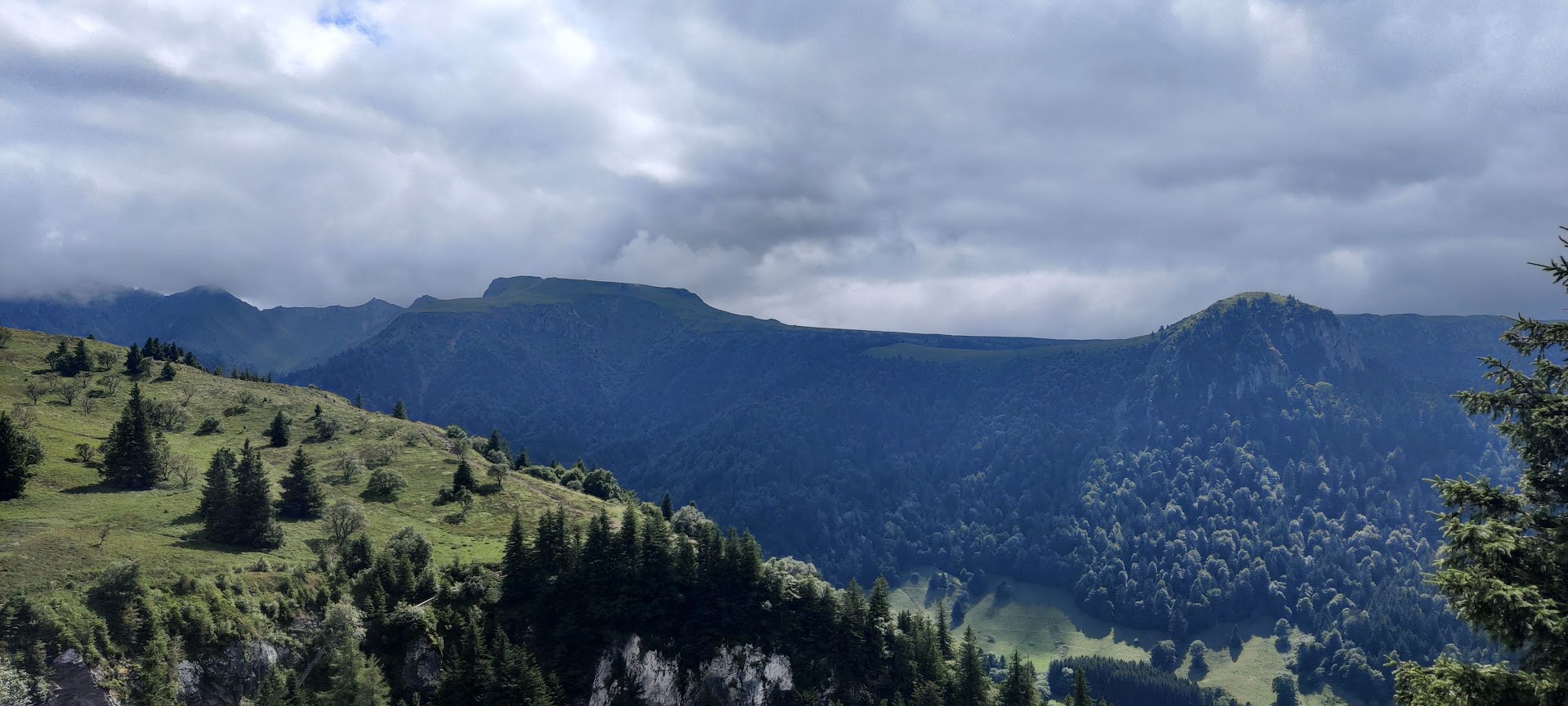
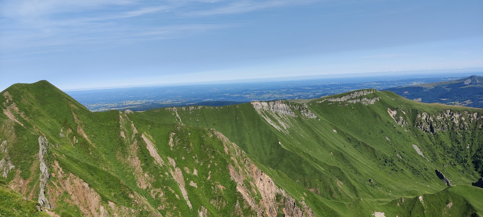
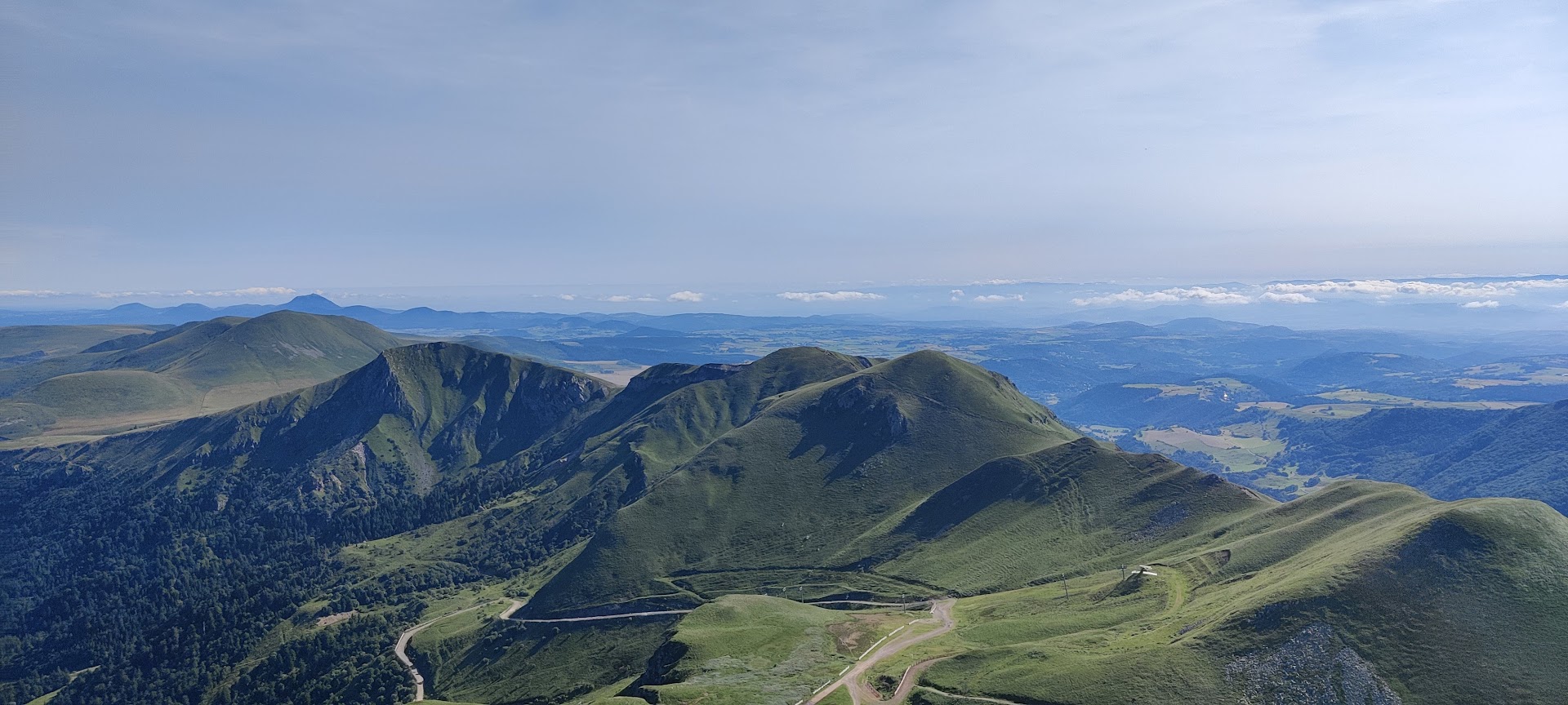
We climb well, rest here and there, but keep a good rhythm. It’s time for the last climb to the summit of Puy de Snacy. The trail winds through and around the anti-errosion works that have been applied on the mountain side. And then we reach the summit, with a breathtaking view of the big old crater before us. We can clearly see the western ridge where we walked on the first day and the eastern ridge we did on the second day.
There is a lot of people on the summit, so we don’t linger long. There’s only the descent from the summit to the cable car station left. We board the cable car and make our descent back to where we started almost 4 days ago.
And this marks the end of our great adventure. We did it!
It was hard.
It was fun.
It was fun to do this together.
It was beautiful.
It was epic.
I am proud of what we achieved together. I am proud of what my kids did!
We sure succeeded to pass on the concept of “sometimes you have to push on when it’s hard, in order to enjoy it even more afterwards” to our kids, especially the 2 youngest. Even if it was hard work for them at moments, they all told us afterwards that they had fun and had enjoyed it.
We will do this again!
EG = Elevation Gain ↩
If you want to react to this post, you can contact me: