After digesting my DNF on Oslo Bergen Trail, I started thinking about my next project. I quickly decided that it would be a solo adventure and not a race. Mainly to leave the pressure off my shoulders.
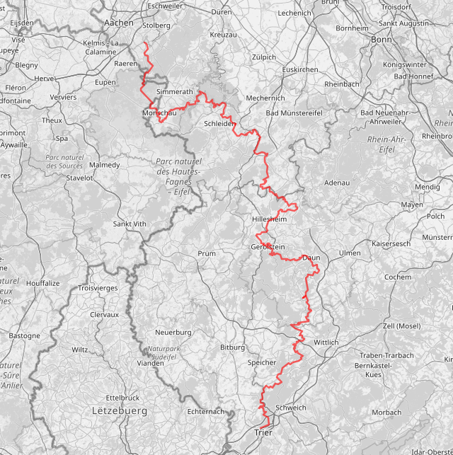
The Eifelsteig is a permanently marked long distance trail through the Eifel in Germany.
It connects the historic cities of Aachen in North Rhine-Westphalia and Trier in Rhineland Palatinate, and offers so much impressive nature in between.
Taking “Just you, the water and the rocks” as its slogan, the Eifelsteig hiking trail leads into the largest still intact highland moor in Europe, the Hohes Venn, through the only National Park in North Rhine-Westphalia, past relics of the volcanic past of the Eifel in the Volcanic Eifel and on to the unmistakable red sandstone rocks overlooking Trier.
The official trail measures 313km with some 7500m of Elevation Gain (EG). This sounds ideal for a multi-day adventure.
I used my personal ferrett tracker to track my location and communicate with followers.
These are the Strava activities:
I want to run this trail in 4 days: 3 longer days and a shorter day at the end. During the daily stages, I would be totally autonomous. For the nights, I will be supported by Mieke. We rented a roof tent for our VW Caravelle. The inside of the van was reformed into an impromptu camper.
We started to look around for camping sites that are close to the trail. This means that Mieke could set up camp during the afternoon, and I could arrive from my day long run when I arrived.
Due to the location of the camping sites, I had to shuffle my stages around a bit, ending up with having the shorter stage on day 3 instead of day 4.
| planned | real | |
|---|---|---|
| distance | 90km | 93.53km |
| elevation gain | 2676m | 2748m |
| time | 13h11 | 12h48 |
| moving time | 10h54 |
I have 2 water resupply points planned:
The night before the run is spent on the camping site of Roetgen, which is a 15’ drive from the starting point of the Eifelsteig in Kornelimünster. The automatic gate only opens from 07:00. This means I must postpone my start from 06:00 towards 07:25.
07:25 Last check of all my gear, and I’m offski1!
The weather is pleasant: it’s dry and about 12°C.
In the town streets I have some difficulty noticing the Eifelsteig marks.
But a couple of minutes later the trail leaves town and plunges into a forest.
The biggest advantage of starting later than planned is that I can quickly stow away my head torch.
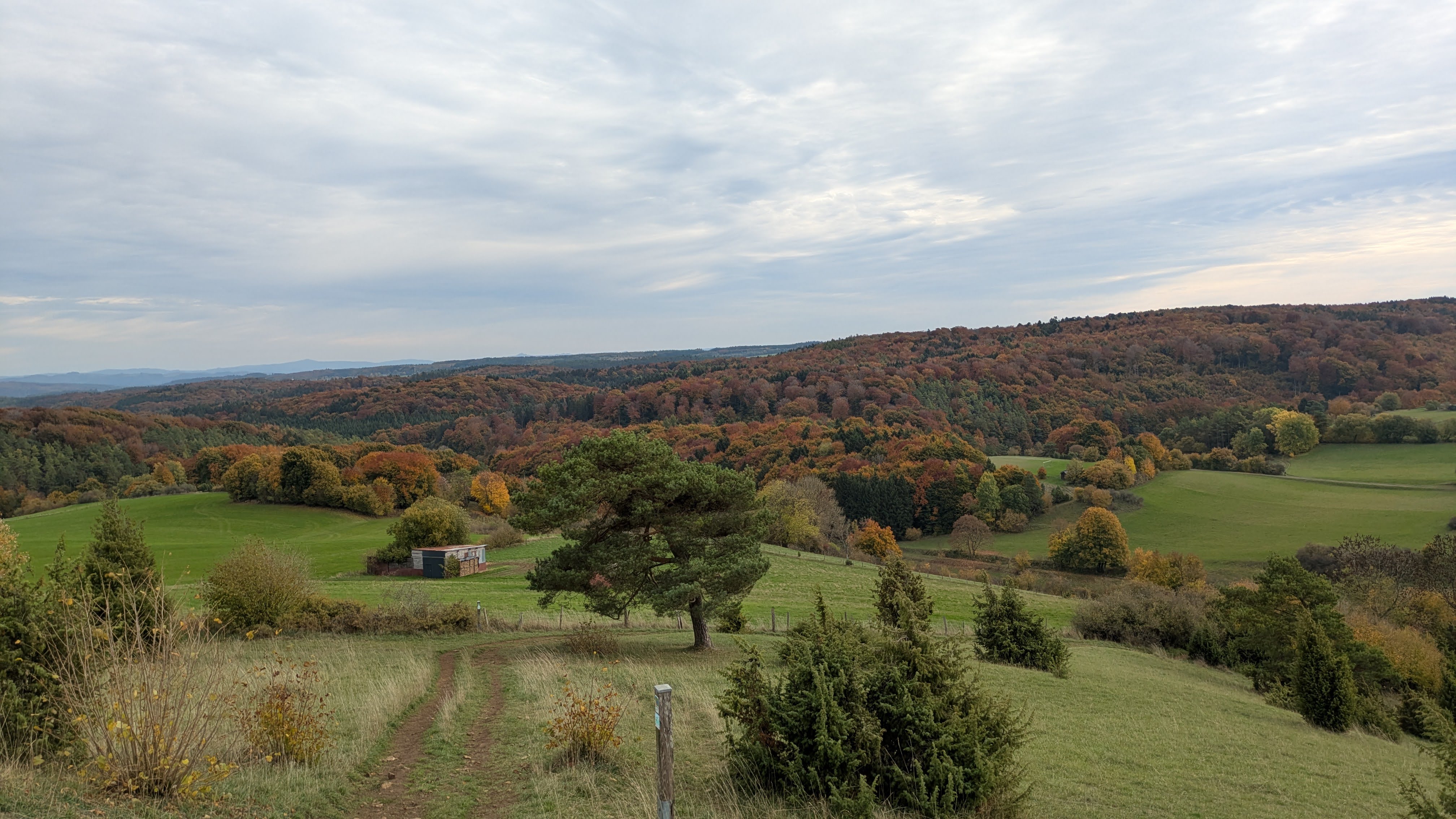
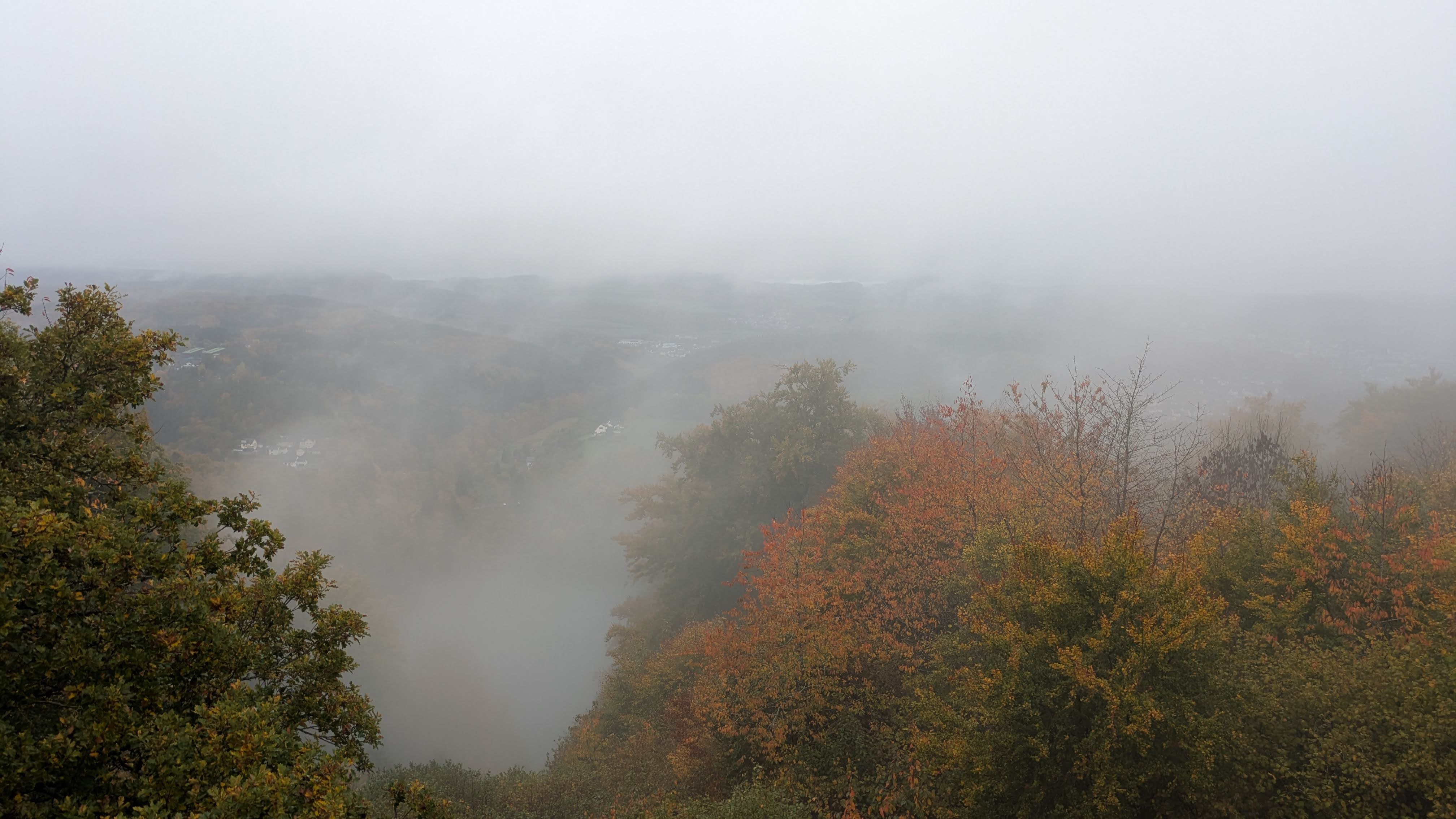
The surroundings are beautiful, especially with all these nice autumn colors.
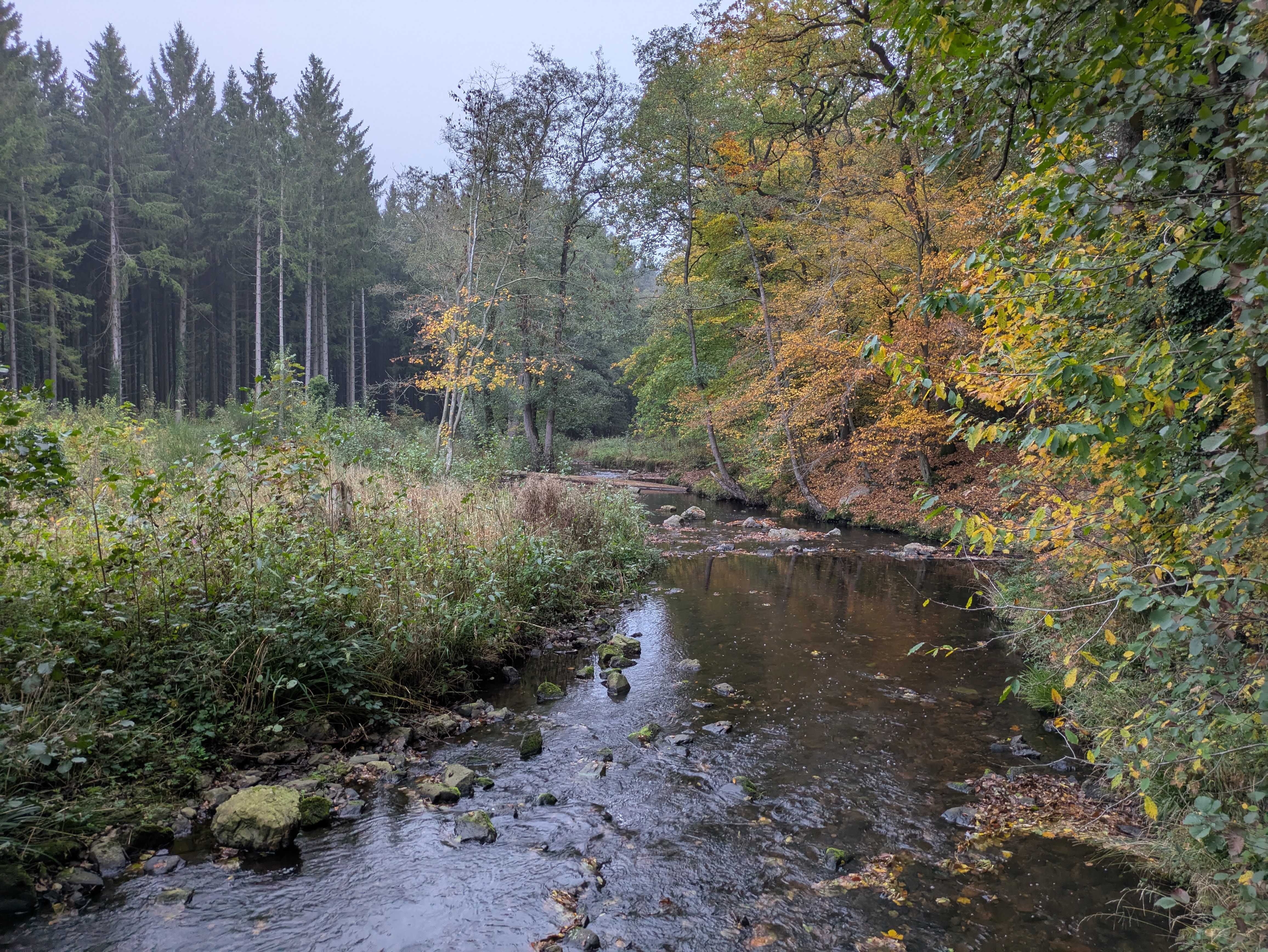
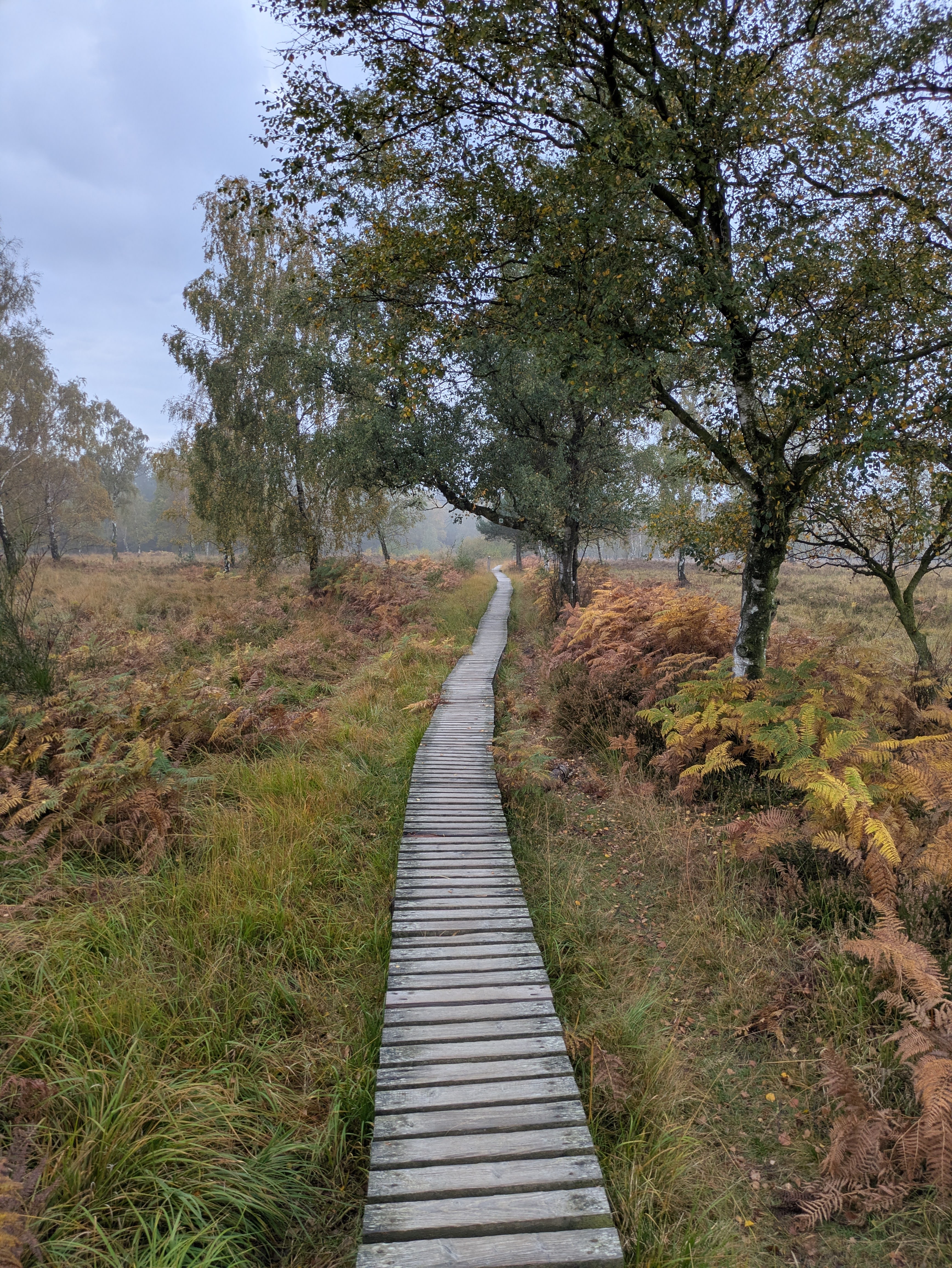
08:43 After the first bigger climb, I am in the moorlands of Hohes Venn.
This is the German part of these moorlands, which also stretch into Belgium.
I have been in the Belgian part on several occasion before, amongst those my run of Venntrilogie with Piet.
The trail leads over a boardwalk, which is so typical for trails in Hohes Venn.
09:57 After only 10minutes on the Belgian side of the border, I encounter the first party of hunters.
Luckily, they are only starting their preparation and let me through to continue.
This part of the trail is one 5km long old road, consisting of grass growing out of ages old asphalt.
The road is straight and climbs slightly all the time.
This was slightly boring, but I am back in a forest, overlooking Mützenich, an exclave of Germany in Belgium.
11:09 There is water at the camper parking in Monschau.
But it comes out of a machine that needs a 1 EURO coin to operate.
Let that be something I am not carrying in my pack.
I ask two different people if they could lend me a 1 EURO coin, but they can’t. While I am packing my sports drink powder away and getting ready to continue my search for water, an elderly couple parks their old, modified van next to the water point. They started talking to me, and I explained my water situation. The man quickly gets his purse out and gives me a coin. In answer to my question what I can do to repay him; his wife suggests that I sing a song. Which I do. Well, part of a song, anyway. And not very well sung.
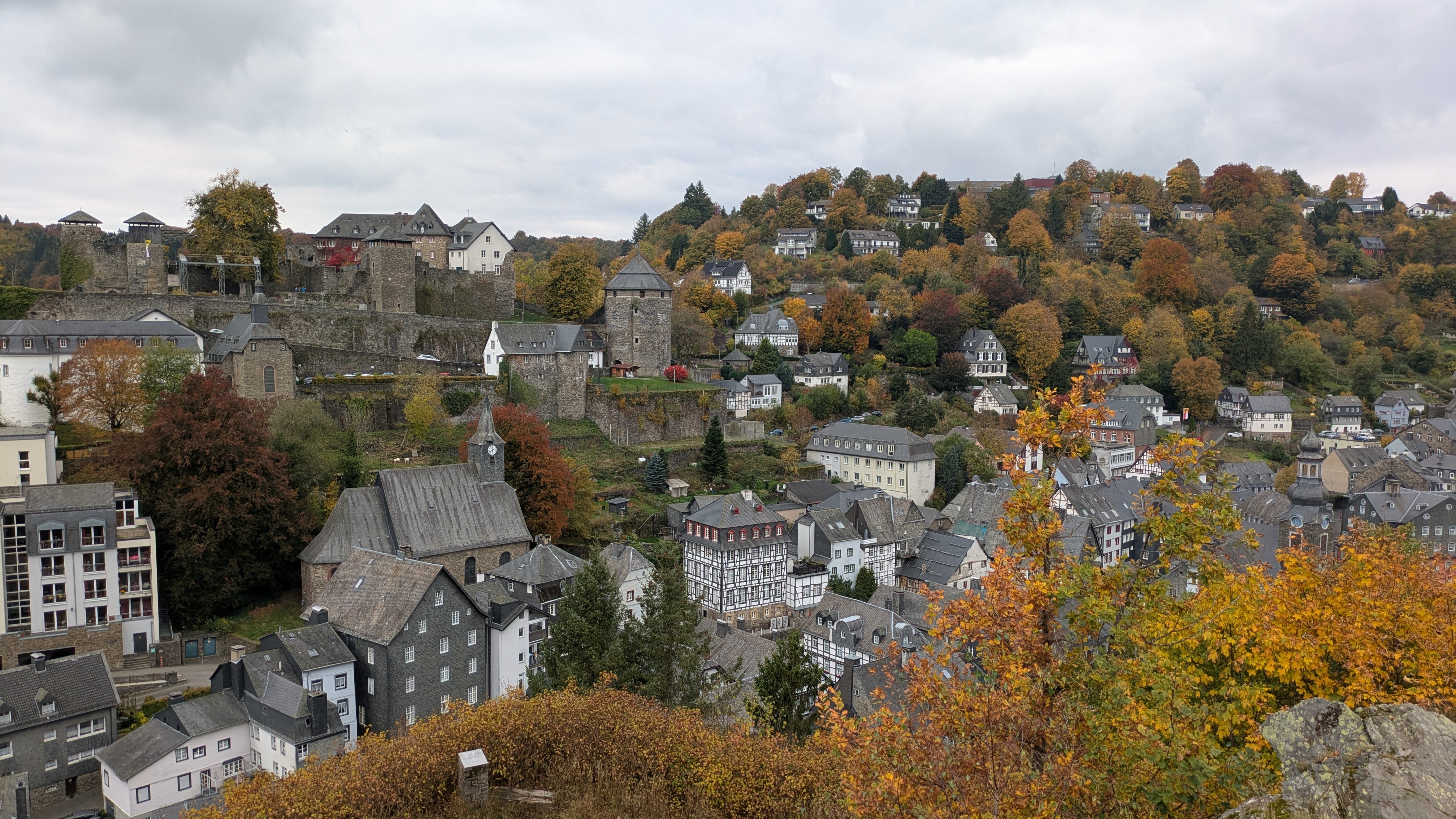
11:36 With a last view over Monschau, I leave the tourist packed town behind me and get back into the forest.
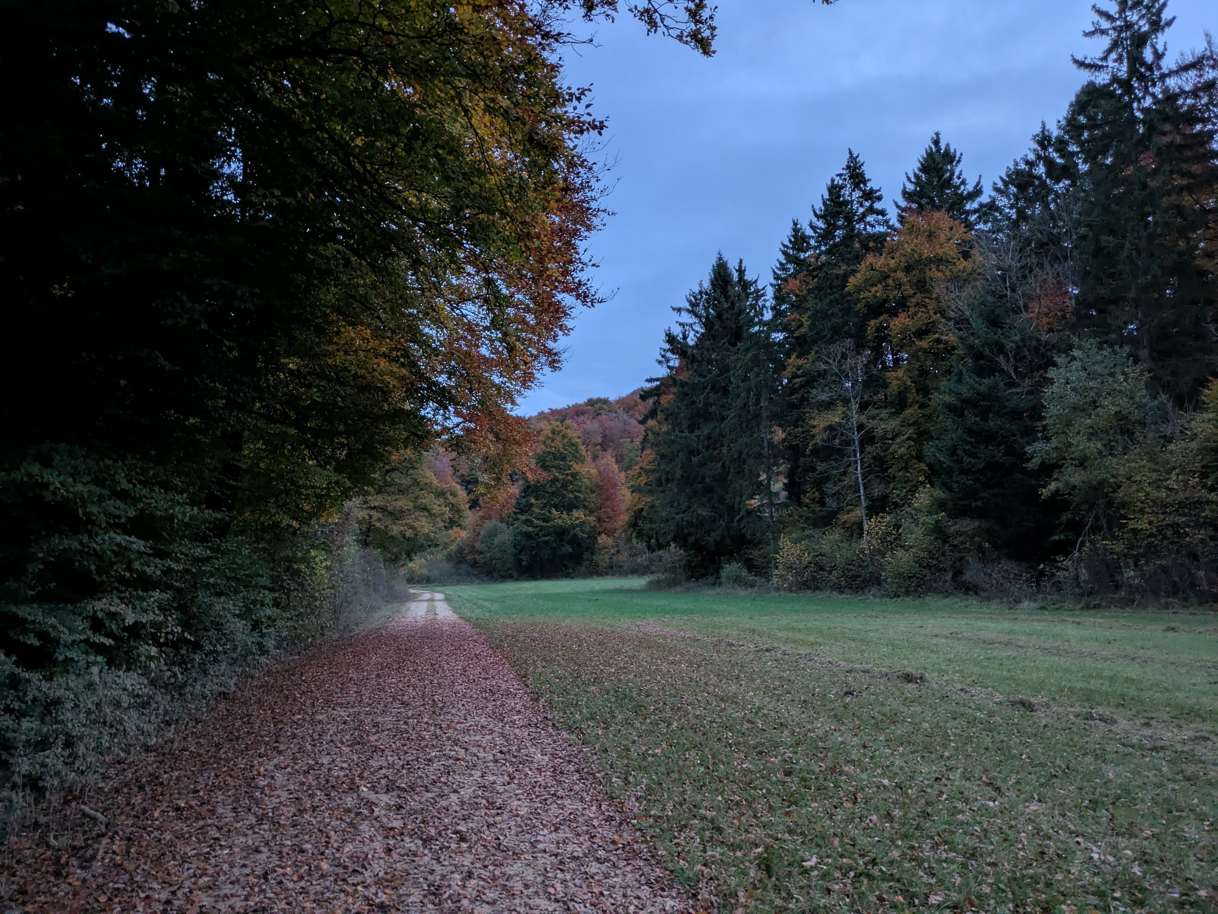
The trail leads me through a mix of forests and farmlands. Now and then I cross a small village. The sun is hidden behind a vast cloud cover. But the trees give me a lot of different colors to enjoy.
I am having fun and am advancing well.
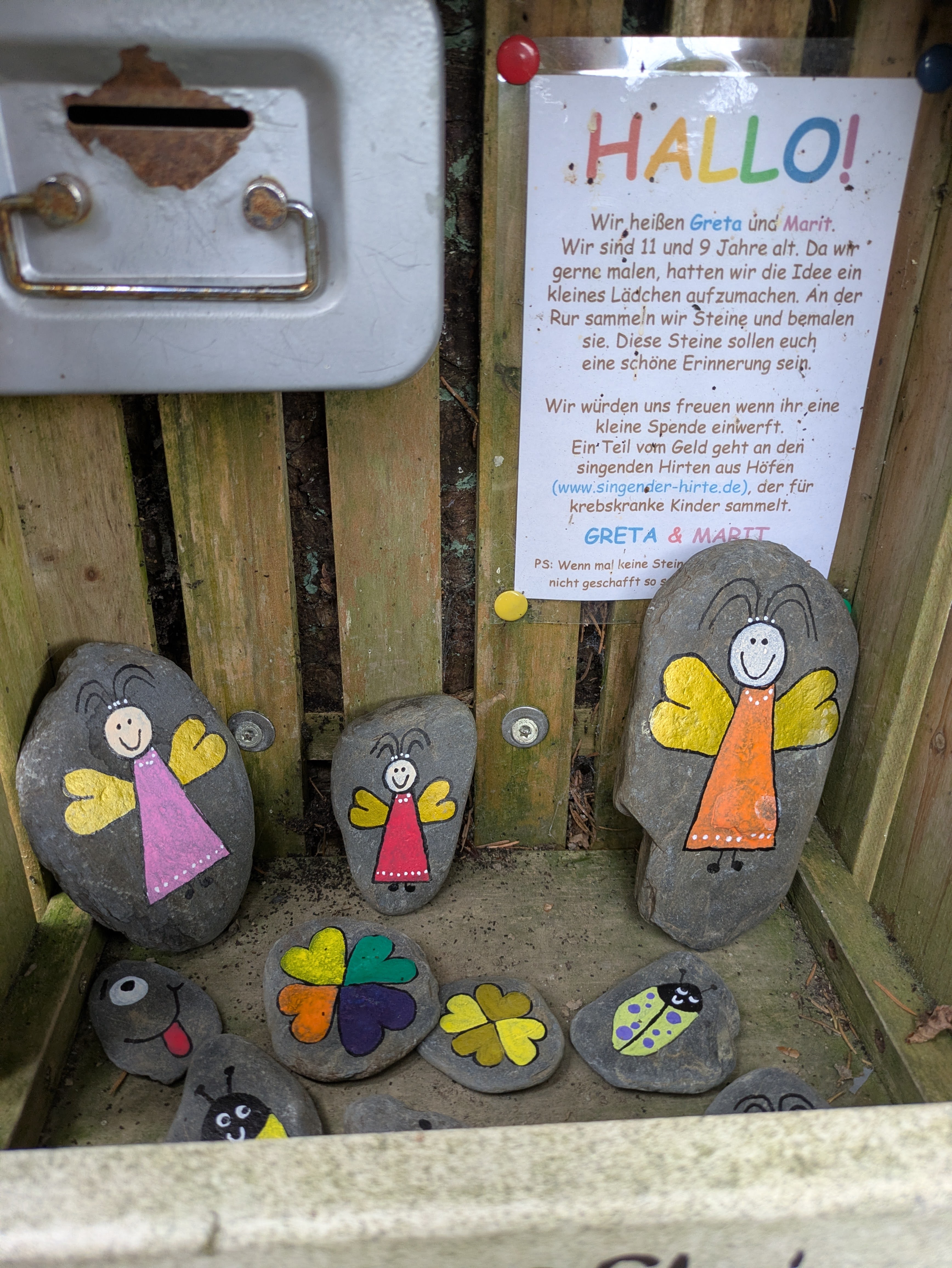
12:34 Nailed to a tree on a small forest path is an open sided box.
In the box are several stones, painted by Greta and Marit, two local girls (I suppose).
I picked up a stone with a green ladybird with purple dots.
This will be my lucky stone for the rest of my journey.
13:48 For the last 20minutes I have promised myself a break as soon as I see a bench to sit on.
Finally, I spot a nice rock that is high enough to sit comfortably.
I have been on my feet for over 6 hours and covered almost 50km, so this is a good moment for a break.
I’m enjoying a couple of savory muffins, baked by Mieke (pumpkin+bacon and zucchini+ham). 😋
While checking the route for the rest of the day on Organic Maps, I spot a water fountain nearby. Even if I still have plenty of water left, I decide to top off my bottle with water.
15:10 I pass through the town of Einruhr.
Just outside of town, I stop at the cemetery to fill my bottles again.
This should get me to the end of today’s stage and to CP1.
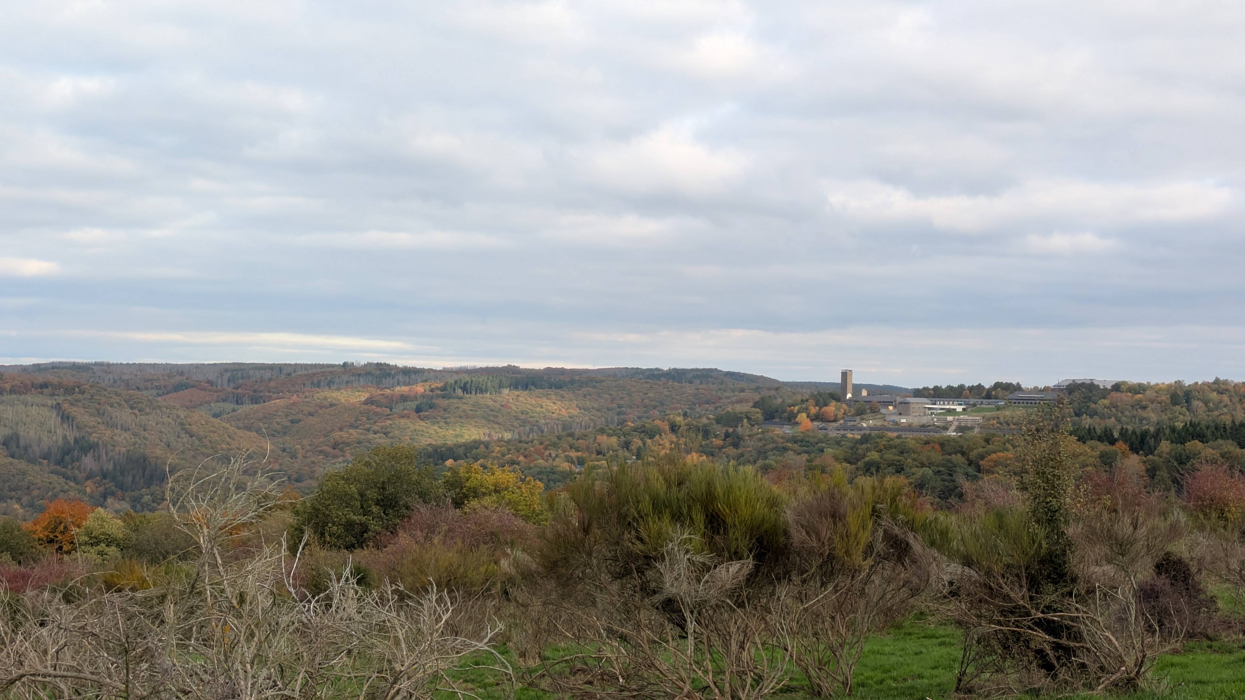
16:28 Nearly at the summit of a longer climb towards Wollseifen, I feel a bit tired.
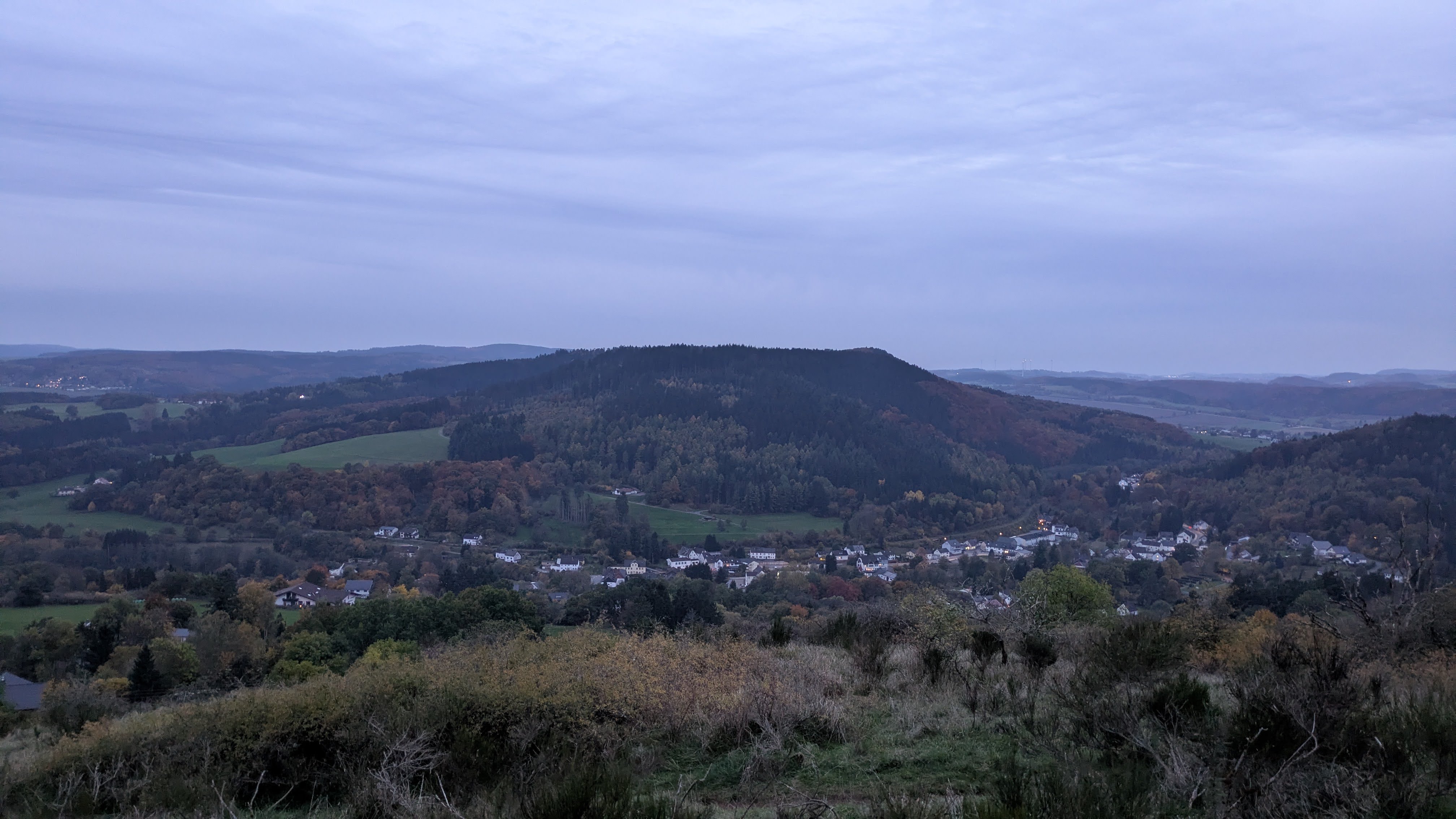
I decided to take a small break, with a view over the Urft-valley and of Vogelsang in the distance.
While sitting down on the grass, I see a large flight of cranes flying over.
Majestic!
18:26 In Gemünd, I decide to stop at a shop and buy a bottle of Coca Cola.
Somehow, for a reason I don’t recall, I had decided not to make sports drink when refilling my bottles in Einruhr.
I feel like I might need some extra sugar, and the caffeine would do me some good too.
Only 13km and 2 big climbs left. I am starting to count down towards arriving in CP1.
Back in the forest, I stopped to get my head torch out of my pack. It’s getting dark, and I am having trouble seeing the small arrows on or beneath the Eifelsteig marks without light.
20:11 In the village of Golbach, some 50m in front of me, I spot someone wearing a head torch.
It’s Mieke, guiding me in towards CP1.
She made delicious spaghetti.
It has been a good running day. I had some moments that were difficult because I was getting tired. But I easily regained my mental strength and carried on without much trouble. My legs are obviously tired, but nothing hurts much. I feel confident that a good night’s sleep will get me ready to tackle the second stage tomorrow.
A warm shower and time to hit the sack!
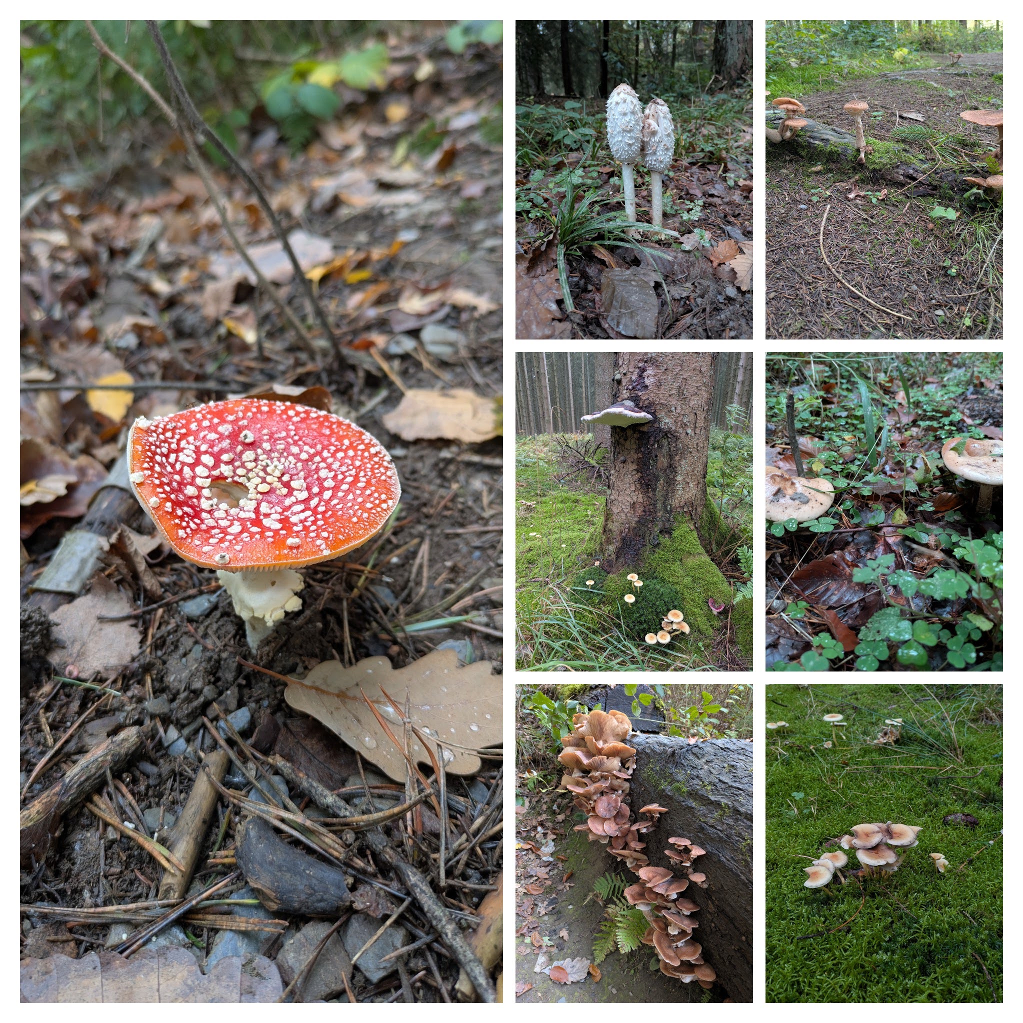
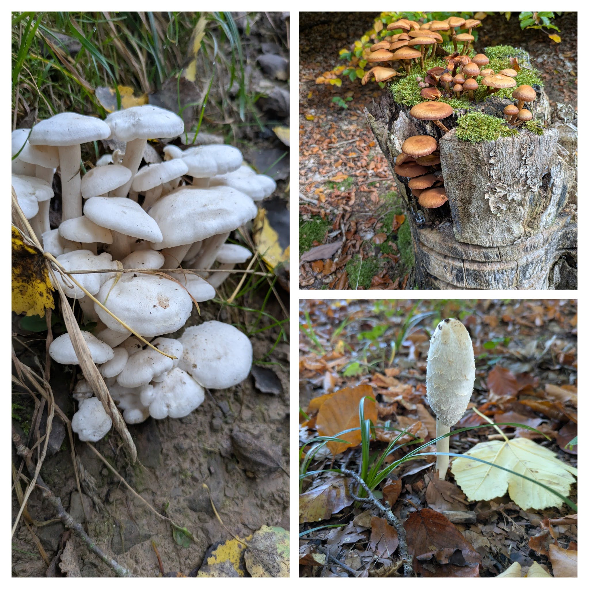
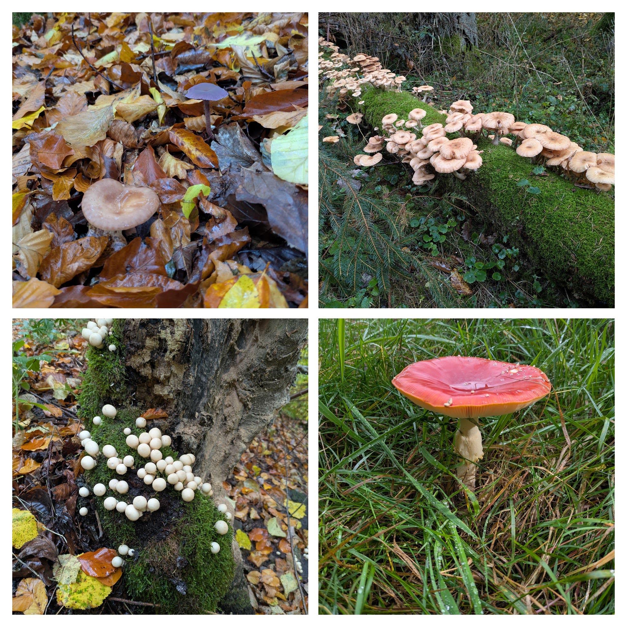
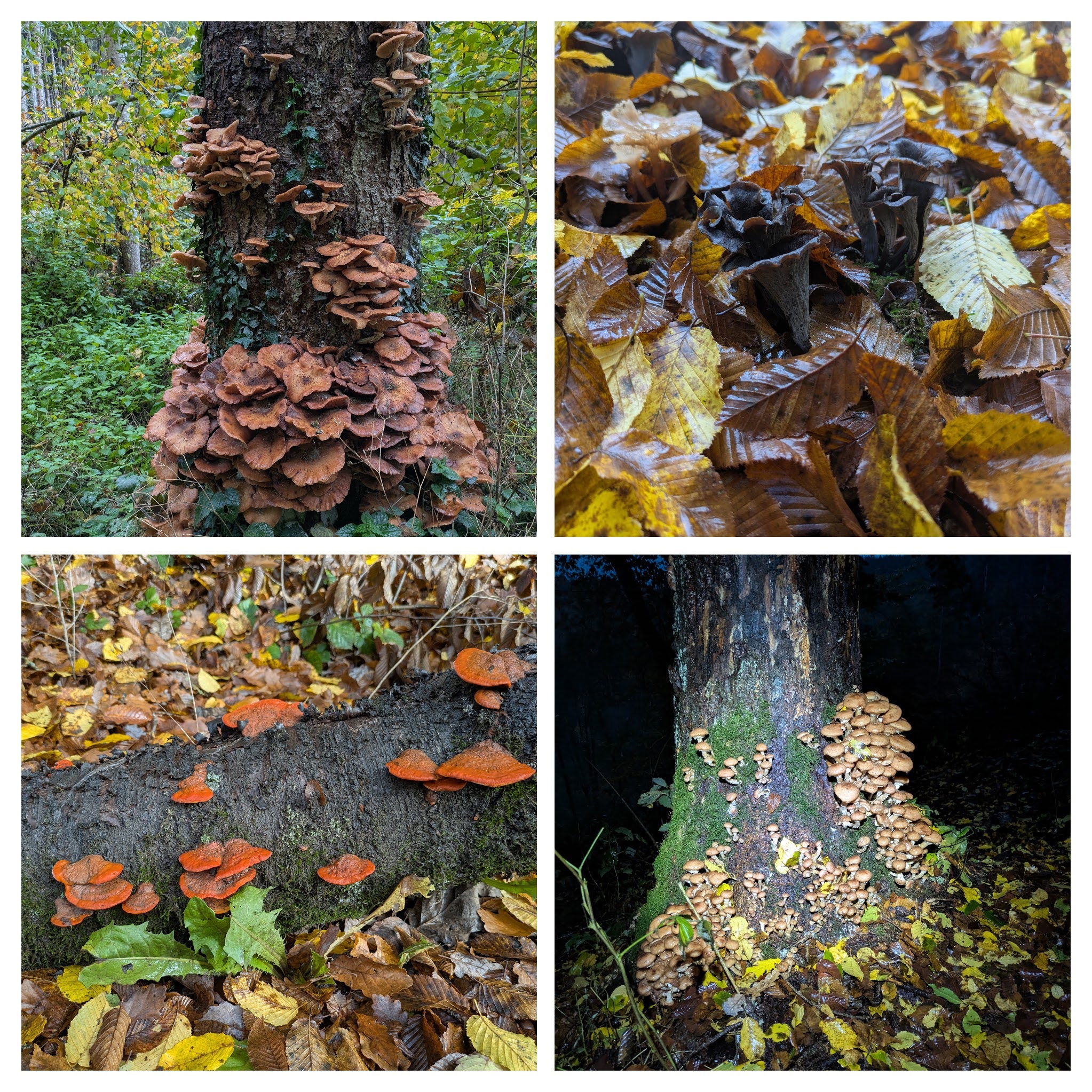
As a bonus: I saw a lot of nice mushrooms and toadstools today. Here are those that stood out the most:
| planned | real | |
|---|---|---|
| distance | 88km | 90.68km |
| elevation gain | 1788m | 1953m |
| time | 12h01 | 13h10 |
| moving time | 11h03 |
I have 2 water resupply points planned:
05:00 My alarm wakes me after not so good night sleep.
It had been cold and humid in our roof tent.
The night before we had kept the tent closed, which yielded a wet tent on the inside due to our humidity that could not escape.
Our duvet and sheet were humid.
On this second night we had left 2 windows open at the top and at our feet end of the tent.
I slip out of our tent, careful not to wake Mieke. I eat the rest of yesterday’s spaghetti, meanwhile making myself a cup of coffee. I feel relatively good. My legs are a bit stiff, but not too much. I am eager to get moving again.
06:07 Preparations always take more time when you’re camping than when you would be at home.
But here I am, ready to start running again.
Running out of Golbach, the trail hits a forest first, and then some farmlands.
A couple of small hills up and down, and I am descending towards Nettersheim.
There the Eifelsteig starts to loosely follow a train track in the valley of the Urft. For large portions of the day, I run over broad gravel paths. That can be a bit tedious.
10:07 On a bench in the forest overlooking Blankenheim, I take a break after 4 hours of running and hiking.
I no longer run uphill as I had done on several occasions yesterday.
But I am still moving well and attain a good pace hiking uphill using my poles.
I had refilled my bottles at the cemetery some minutes before entering this forest.
I savor a big Mieke-made muesli bar.
12:10 I need to take another break.
I start to feel a slight pain on the inside of my right foot.
It doesn’t bother me too much at the moment, but I still want to sit down for a moment while eating.
There’s a stiff breeze blowing, it’s a good thing I have extra layers in my pack.
13:13 I have calculated that I might need a water supply earlier than my planned second spot at Niederehe.
When passing by the church in the small village of Mirbach, I spot a cemetery.
It was a good call: there is a water tap.
The views are still beautiful: the color patches of the forests mixed with the bright green of the pastures.
14:15 I sent Mieke a message telling her about the niggle on my right foot.
It’s starting to bother me more.
I stop for stretching the different muscles in my right leg, hoping that this will help.
And then those in my left leg, while I’m at it.
I focus on my midfoot landing, trying to engage my glutes and hamstrings a bit more, to prevent my foot from dropping to the inside.
This is also starting to turn around in my head. I have only covered 55km today, which still leaves me a lot of Eifelsteig before the end. If the pain gets worse, will I still be able to move well? Will I be able to continue to the finish?
14:28 I stop again to look at my foot, taking off shoe and sock.
It’s a bit swollen and there is one point that hurts at touch.
I massage the spot and the area around it.
I take a pain killer.
And then I want to continue, keeping my focus on how I position my feet when landing them.
The pain doesn’t get worse. My head clears. I continue!
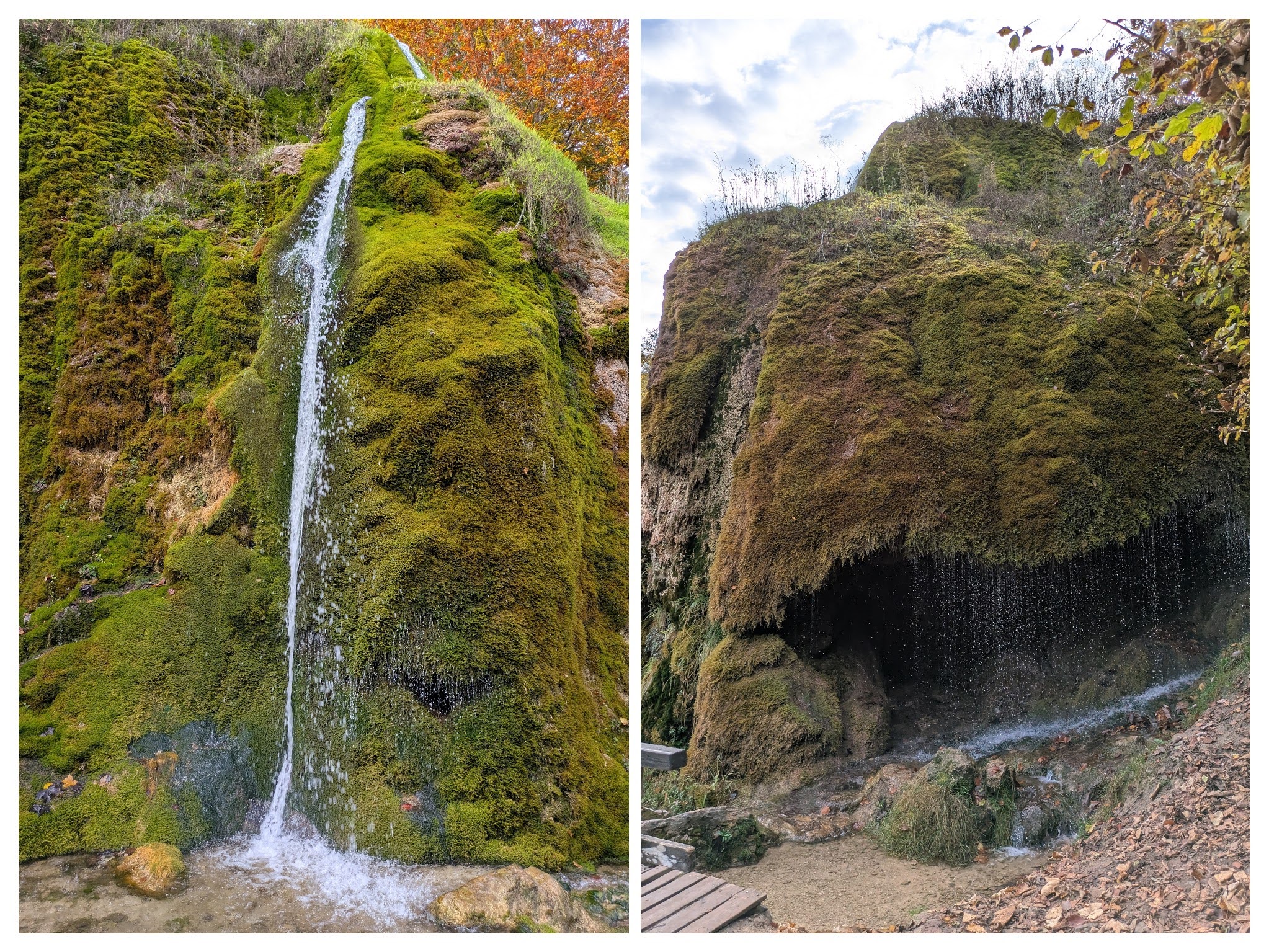
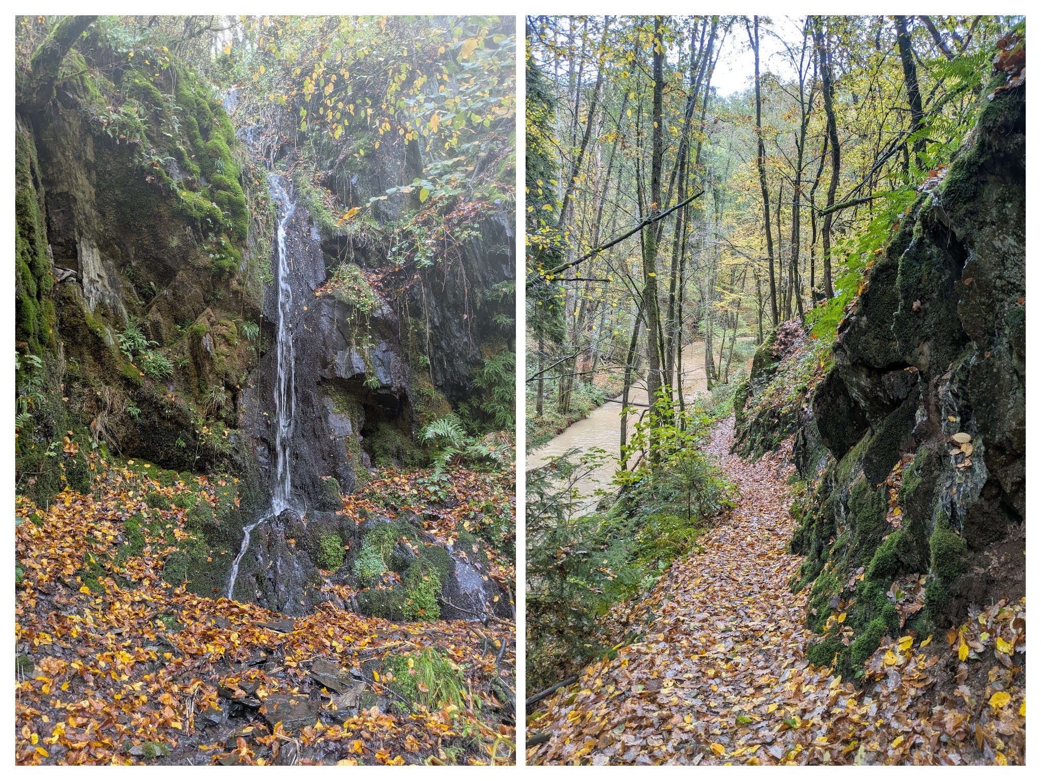
15:14 The trail passes by the Dreimühlen Wasserfall.
A very nice waterfall in two parts: a light curtain on one side of the rock and a classic jet on the other side.
The pain in my right foot isn’t getting any worse. It’s still there, but just as a annoying niggle, as long as I stay focused on how I land my foot. The doom thoughts about not finishing are all gone. I feel mentally strong again.
Somewhere in the afternoon or early evening, I must have refilled my bottles, but I don’t remember where. The logical place would have been the cemetery at Niederehe, where I had planned to stop. But I don’t recall stopping there, and my tracked activity doesn’t show me stopping there either.
18:34 The last climb of the day, up to the summit of the Rother Kopf is behind me, now it’s downhill to CP2.
I enjoy a nice last view before plunging back into the forest, head torch lit.
19:17 I am at CP2, installed in a camping site just north of Gerolstein.
Just as I arrive a drizzle starts.
I am tired, my legs are tired.
Time for food and rest!
Here’s my mushrooms selection of the day:
| planned | real | |
|---|---|---|
| distance | 53km | 58.78km |
| elevation gain | 1584m | 1841m |
| time | 07h45 | 09h19 |
| moving time | 07h44 |
I have 1 water resupply point planned:
I decided to sleep an extra hour. Today I have only a shorter distance to cover. This will allow me to take a bit more time during the day and to have extra rest in the afternoon. It has been raining or drizzling almost the whole night.
07:08 There’s a faint drizzle.
I decide to start running in my rain jacket and gloves, but not my water proof pants.
After less than half an hour, I am soaked in sweat beneath my jacket.
But my waterproof gloves seem to be on point: dry and warm hands! \o/
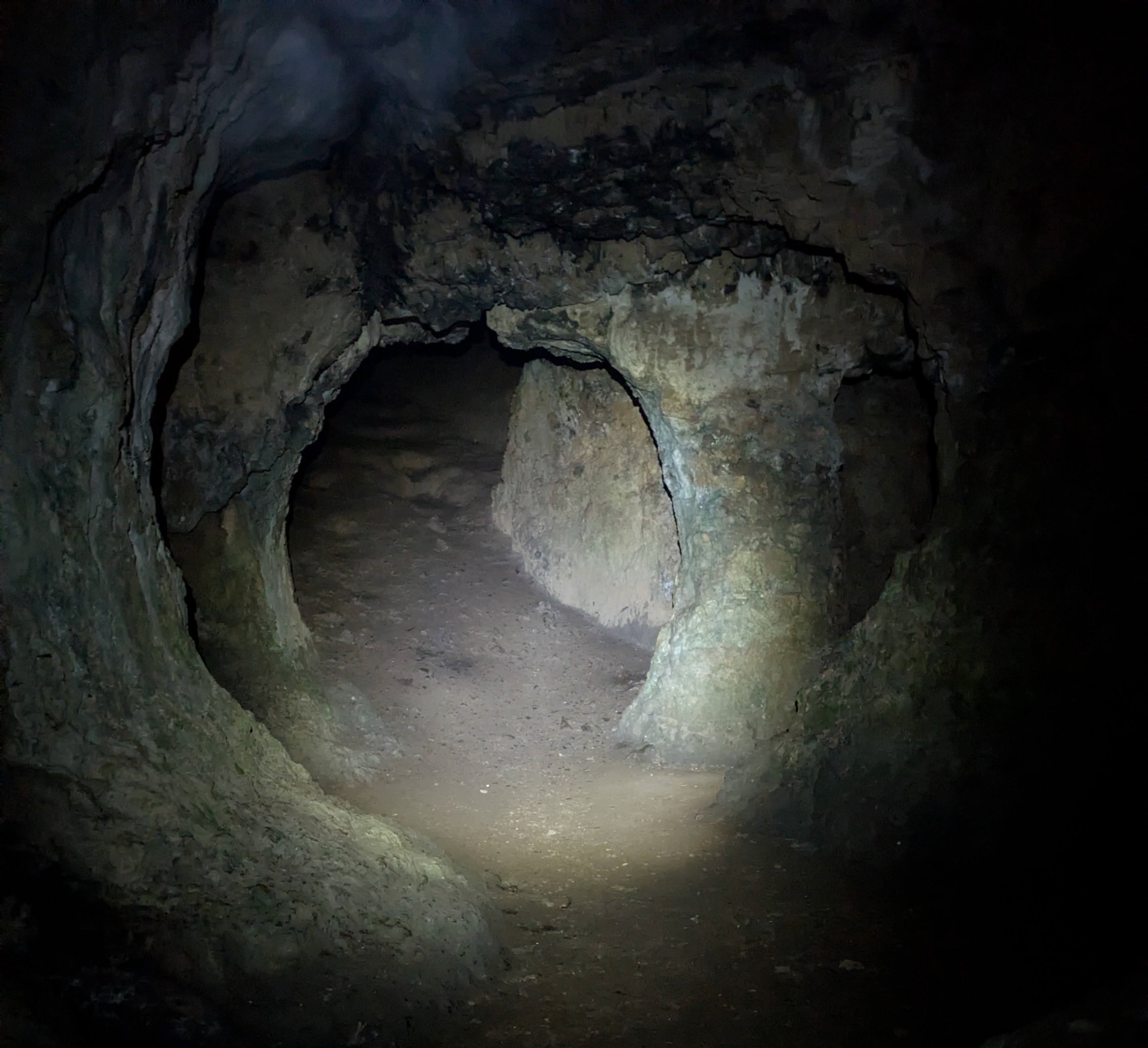
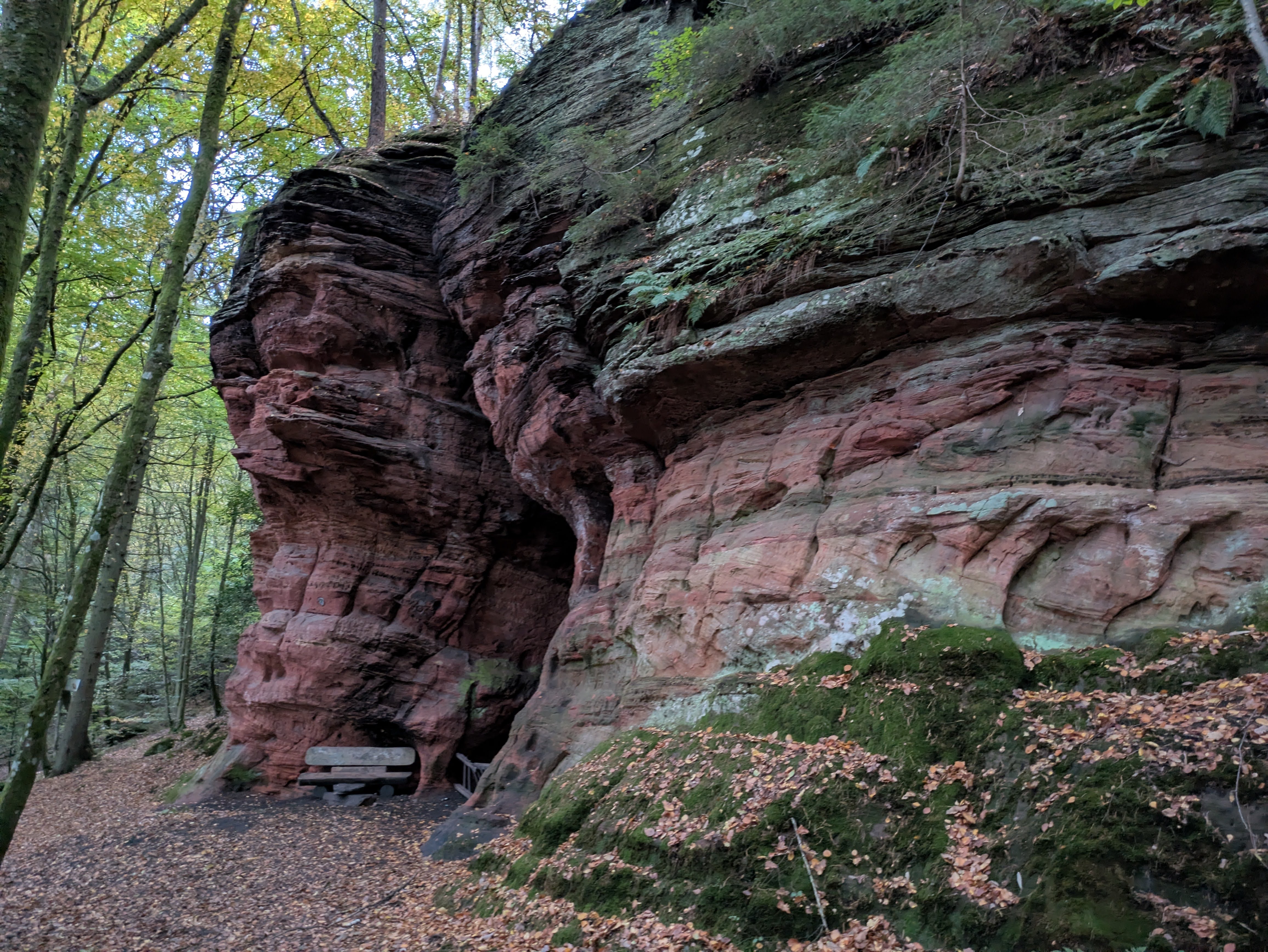
07:49 In the dark forest, suddenly a big rock formation looms over me.
When I get closer, I see the entrance of a cave.
I must take a look inside.
This is a nice dry cave.
One could spend the night here.
08:15 When I enter the town of Gerolstein, my watch indicates that I am off-course.
Not for the first time, nor the last, the GPX downloaded from the website of Eifelsteig doesn’t match the real path.
That’s not a big problem, as I can follow the signs.
But I won’t get a warning when I am really off-course.
09:18 I realize that I am moving slower than I planned.
I made the pacing plan for the 4 days as if each day was a one-day adventure.
That is based on a full night’s sleep, and the anticipated recovery I would get from it.
But reality is different: I move slower.
I quickly realized that it doesn’t matter.
I will finish when I finish, no problem.
10:40 After crossing a road near Neroth, and while looking for the next sign, I heard someone calling my name.
Mieke is waiting for me with warm soup!
What a great surprise. 🧡
12:26 There’s no water tap at the Daun cemetery.
I look at the next part of the trail in the Organic Maps app and see a natural spring only 2km further on.
That seems like a good place to refill my bottles.
The water of the spring is lightly salty and naturally sparkling. It really tastes good. And the combination with my sports drinks powder mixes like a kind of lemonade.
Meanwhile it has started raining harder. I decide to put on my waterproof pants to avoid getting wetter and colder.
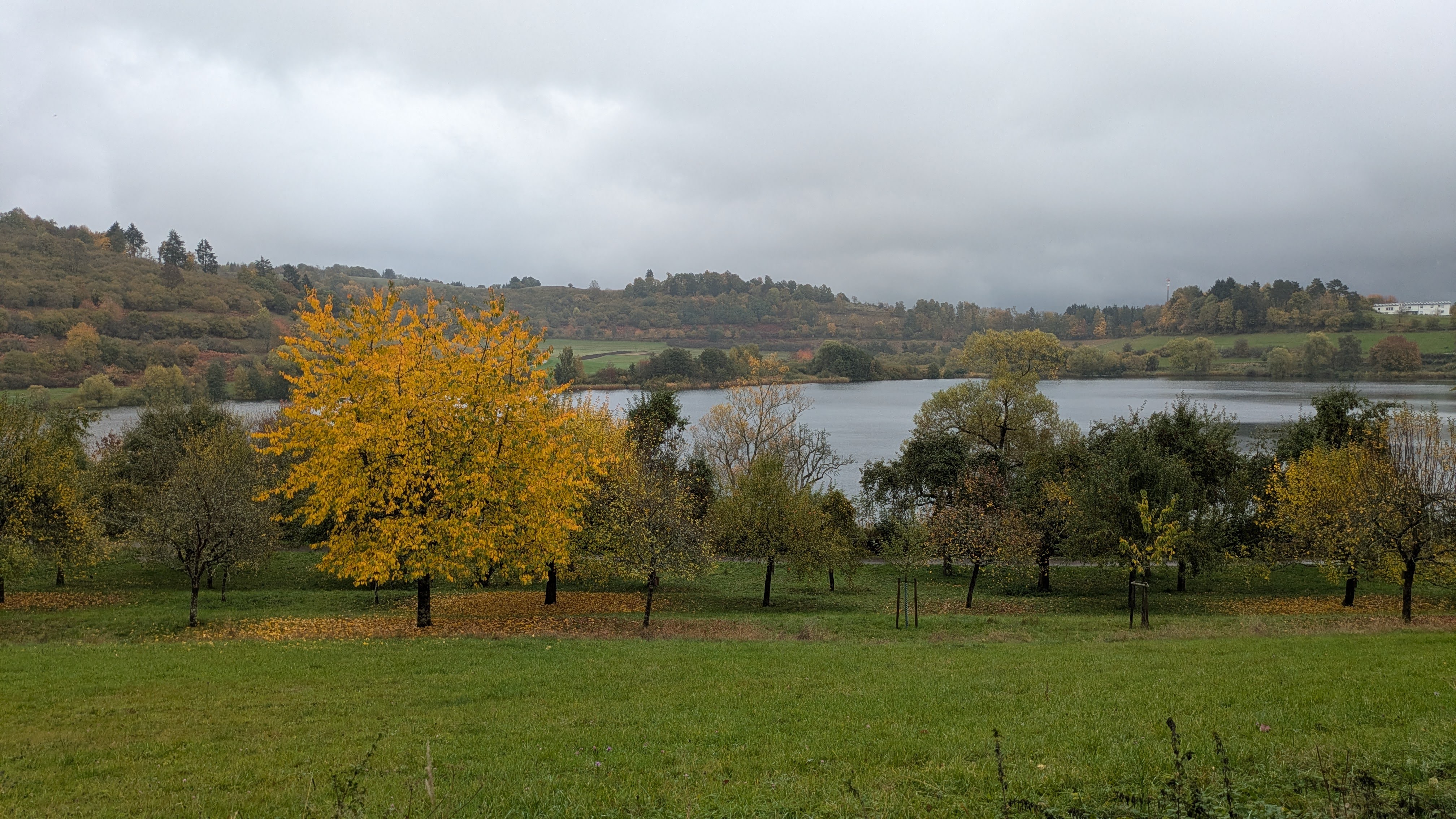
13:17 I am going into the Vulkaneifel natural region.
The trail snakes between and around 3 of the many volcanic lakes in the region.
I have been here a couple of years ago with my family, and I recognize some parts of the trail.
With the background of the autumn forest, it is even more beautiful than I remember.
14:04 In the town of Schalkenmehren, the sun breaks through the clouds.
I stop to put my rain gear away in my pack, and to put on a fresh shirt.
But only 10minutes later, I must stop again and put my jacket back on. Just in time for a good shower.
15:30 Now the sun is out for real.
It has been raining most of the time until now.
I am happy to feel the warmth of the sun on my skin.
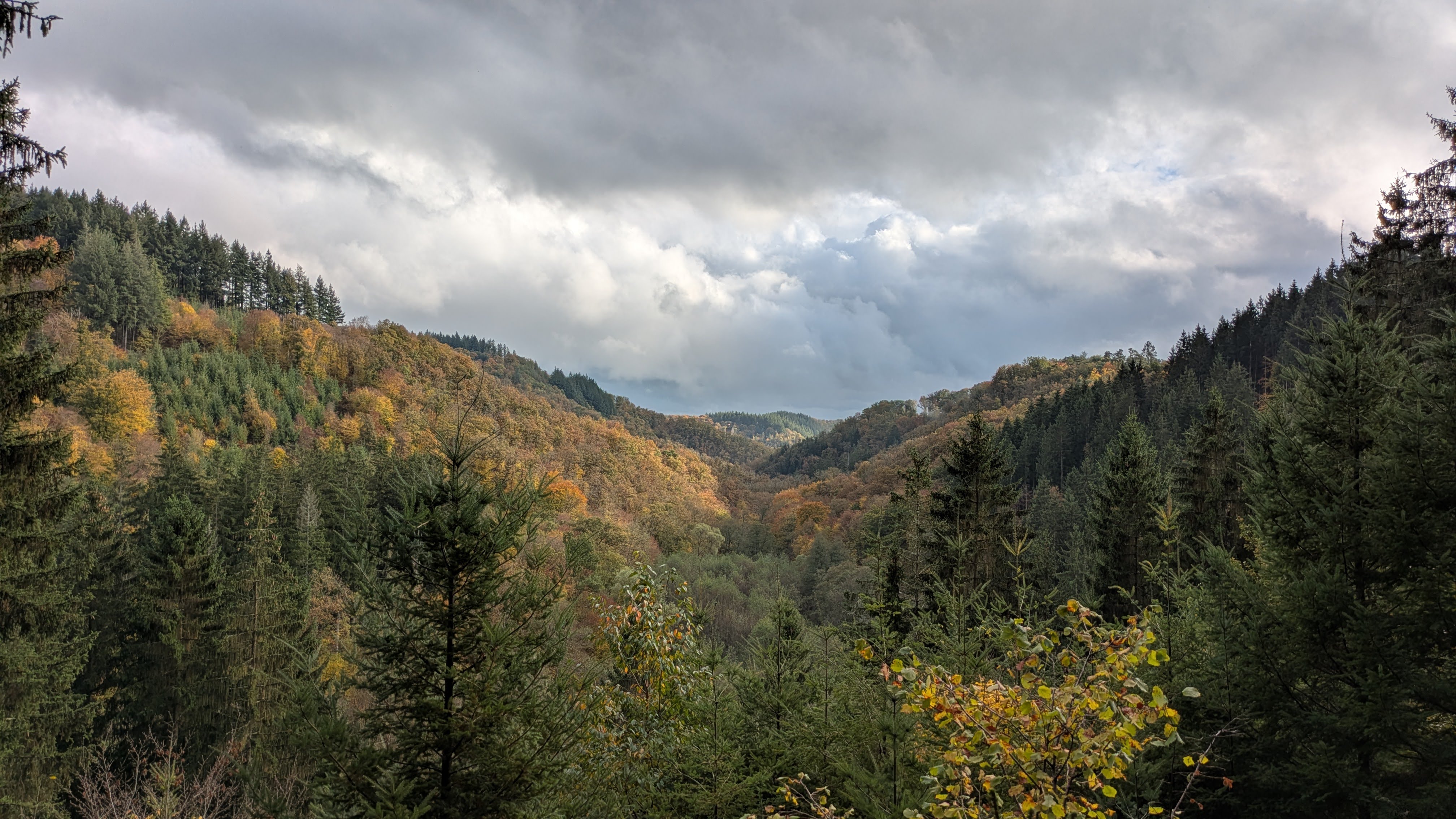
I enjoy running in this beautiful nature.
This part of the Eifelsteig certainly is one of the more beautiful parts.
There are less broad gravel paths than yesterday, and more smaller forest paths.
This makes running even more fun.
And now and then there is a nice viewpoint as cherry on the cake.
16:27 I arrived at the camping site where Mieke set up CP3, just north of Manderscheid.
It is located some 2km from the Eifelsteig, but that doesn’t bother me.
This was a good running day. Even if it rained most of the day, I enjoyed every part of it. Now I have some extra rest time to charge myself again for the long day of running tomorrow.
These are today’s mushrooms:
| planned | real | |
|---|---|---|
| distance | 90km | 92.53km |
| elevation gain | 2100m | 2185m |
| time | 14h14 | 14h22 |
| moving time | 12h18 |
I have 2 water resupply points planned:
After yesterday’s experience with the pacing plan, I adjusted my expected pace for today. I woke up an hour earlier, which would give me more time in the day to finish this final stage and arrive not too late in the evening.
05:11 Full of energy and gusto, I’m off for the last stage: let’s do this!
It’s raining again, and it feels colder than the days before.
I decide to set out in full rain gear.
Yesterday’s food is working my intestines a bit.
Luckily, I spotted a portable toilet near a construction yard in Mandersheid.
The Eifelsteig follows a narrow forest path in the valley of the Lieser, often just next to the river.
09:03 I had hoped to drink a cup of coffee in the coffee bar at Kloster Himmerod.
Unfortunately, the shop is closed.
But the public toilets are open.
This is the third sanitary stop of the morning.
Sauerkraut might not have been the best choice of pre-running food, I guess.
10:57 A small detour into the town of Landscheid, to the local cemetery, to fill my bottles.
All is going well.
The niggle on my right foot isn’t bothering me much.
I am feeling great!
12:11 I take a small break on the central square of Bruch.
I eat a couple of savory muffins and rest my legs a bit.
13:37 I pass by the cemetery at Greverath and use the tap there to top up my bottles, just to be sure to have enough water.
15:46 The bridge is gone!
I followed the marks of Eifelsteig onto the bank of the Kyll, but where both the marks and the GPX would want me to cross, there’s only the river, no bridge.
I wander around a bit, upstream and downstream for some 100m, but no bridges in sight.
I address a passing lady: yes, indeed, there used to be a bridge, but it was demolished a couple of months ago.
I ask her for directions to the next bridge, but it would be a big detour.
Then she suggests that I follow the railway, which has a bridge over the river about a km further downstream.
I decided to do just that and to look at that bridge when I reach it. There is a path next to the railway, but on the inside of the fence surrounding the railway. I follow that path up to said bridge. The bridge is not much larger than the railway, but I could run just next to it. It is about 10m long, maybe 15. I listen carefully, watch in both directions, and start to run. I run at a hard pace. It takes me less than 10seconds to cross.
After the bridge I quickly leave the railway behind me and get back to the trail.
16:12 It’s already time for the next navigational problem.
The trail I should follow is gone under woodworking activities.
There is a sign with “Eifelsteig Umleitung”, which I decide to follow.
At the next crossroads, there’s another Umleitung sign, so I keep following.
But then, there are no signs.
I backtrack to the last sign I saw, follow it, but don’t find the next sign.
I continue to see where the current track would get me. I pass by a cemetery, and use the occasion to fill my bottles again, even if they weren’t empty yet. Better safe than sorry.
In the center of Kordel, I wander around a bit trying to get back on the Eifelsteig. It’s only then that I remembered to use Organic Maps on my phone, which has the GPX loaded, to orient myself and navigate back to the trail. This must be the overall tiredness preventing my brain from working properly. But I’m back on track!
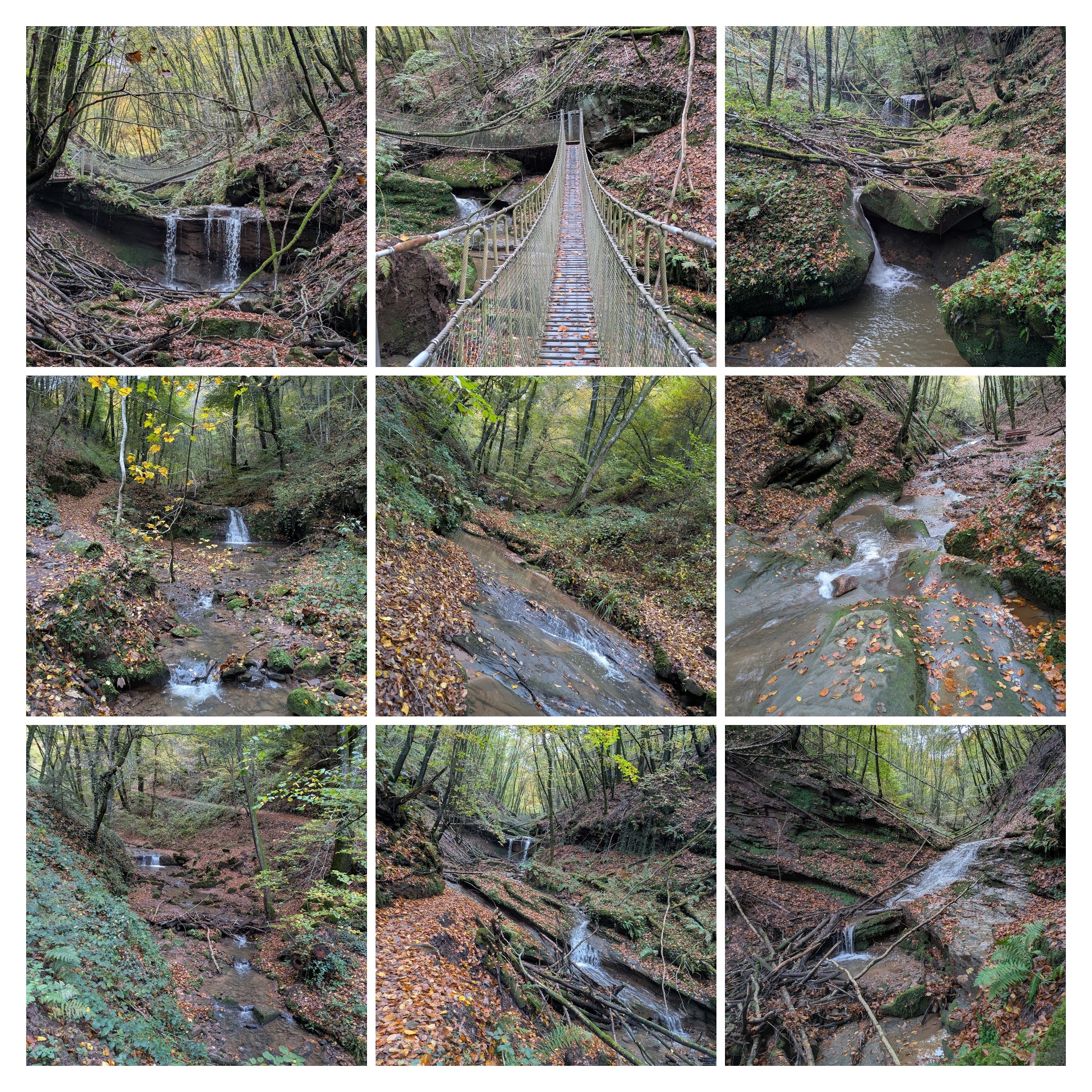
17:04 And then I entered this most beautiful valley: Butzerbachertal.
While climbing the valley upstream along the Butzerbach, I pass a succession of small waterfalls.
The path crosses the river several times.
Near the end of the valley, there are 2 drawbridges.
Magnificent!
I love this place!
18:13 It’s getting dark in the forest, too dark for me to clearly see the arrows on the Eifelsteig signs.
I stop to get my head torch out of my pack.
I pass by several big rock formations, some with half open caves in them, such as Klausenhöhle and Genovahöhle.
This reminds me a bit of Müllerthal in Luxemburg.
I continue through the forest and feel the pull of the finish line. I pick up the pace a little, where possible. I can’t run uphill, but I can power hike.
19:15 After a last stiff climb, I am overlooking Trier at night on the other side of the river Mosel.
I can smell the finish line now.
I continue at a good pace, broadly smiling inside and outside.
19:32 There is Mieke, waiting for me at the finish line of Eifelsteig!
She has a special price for me: a Haribo advent calendar. 😁
And here is the bonus of today’s mushrooms:
I did it!
I must say that it seemed relatively easy in comparison with other multi-day challenges I tried before, such as Northern Traverse, Legends Trail or Oslo Bergen Trail. The way we organized this, with Mieke setting up camp and preparing food every evening, certainly helped a lot. 🧡 Except for the couple of hours in the middle of day 2, I felt mentally strong all the time. There were no other moments where I doubted that I would finish this. My legs felt strong for the whole duration of this adventure. I enjoyed myself most of the time. I felt happy doing what I love most: running in beautiful nature while pushing myself hard.
I needed this. I needed to prove to myself that I could finish a long-distance run. QED. Up to the next run!
an expression I borrowed from Sir Terry Pratchett’s Nac Mac Feegle’s langauge. ↩
If you want to react to this post, you can contact me: