3 days of running and hiking in the Alps, alone. Just me, the trail and the mountains around me. Yes, that sounds like a great gift to myself, days before my 50th birthday.
Rewind 10 months back. I am planning my running year 2026. I have been thinking about a multiday adventure or race in the mountains for some time now. The different races on my bucket list don’t fit in our family planning. A solo adventure is the solution. I research different possibilities. While leafing through one of Mieke’s books on long distance hikes, I read the chapter on Tour of Monte Rosa. This route is not unknown to me: I know of UTMR. Yes, that would make for a nice 3 days adventure. So it is decided then.
I plan to run and hike the complete Tour of Monte Rosa (TMR) in 3 day stages, starting in Grächen in Switzerland, and running clockwise. I will do this on my own, solo and self-supported. I will be sleeping in mountain huts.
| planned | real | |
|---|---|---|
| distance | 67km | 70.13km |
| elevation gain | 3990m | 4151m |
| time | 13h00 | 16h11 |
05:54 Finally, I’m on my way for real!
About 10 minutes ago, while trying to make sense of the signposts, I realized I forgot my glasses.
I returned to our hotel and asked Mieke to bring them down to the front door for me.
I usually run without my glasses, but for this multi-day trip I decided to take them, even if only to be able to make out the details on the mountain views I am to savour.
06:38 I am nearing Hannigalp after a first climb of about 500m of EG.
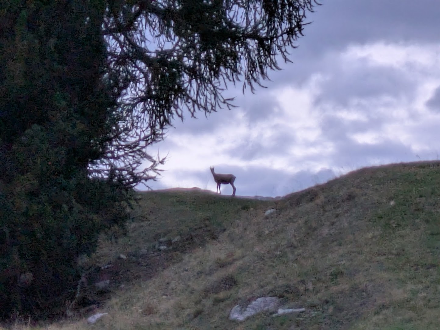
When I look ahead, I see the outline of an animal, a chamois, I think, against the dawn sky.
My first wildlife sighting!
This makes me happy.
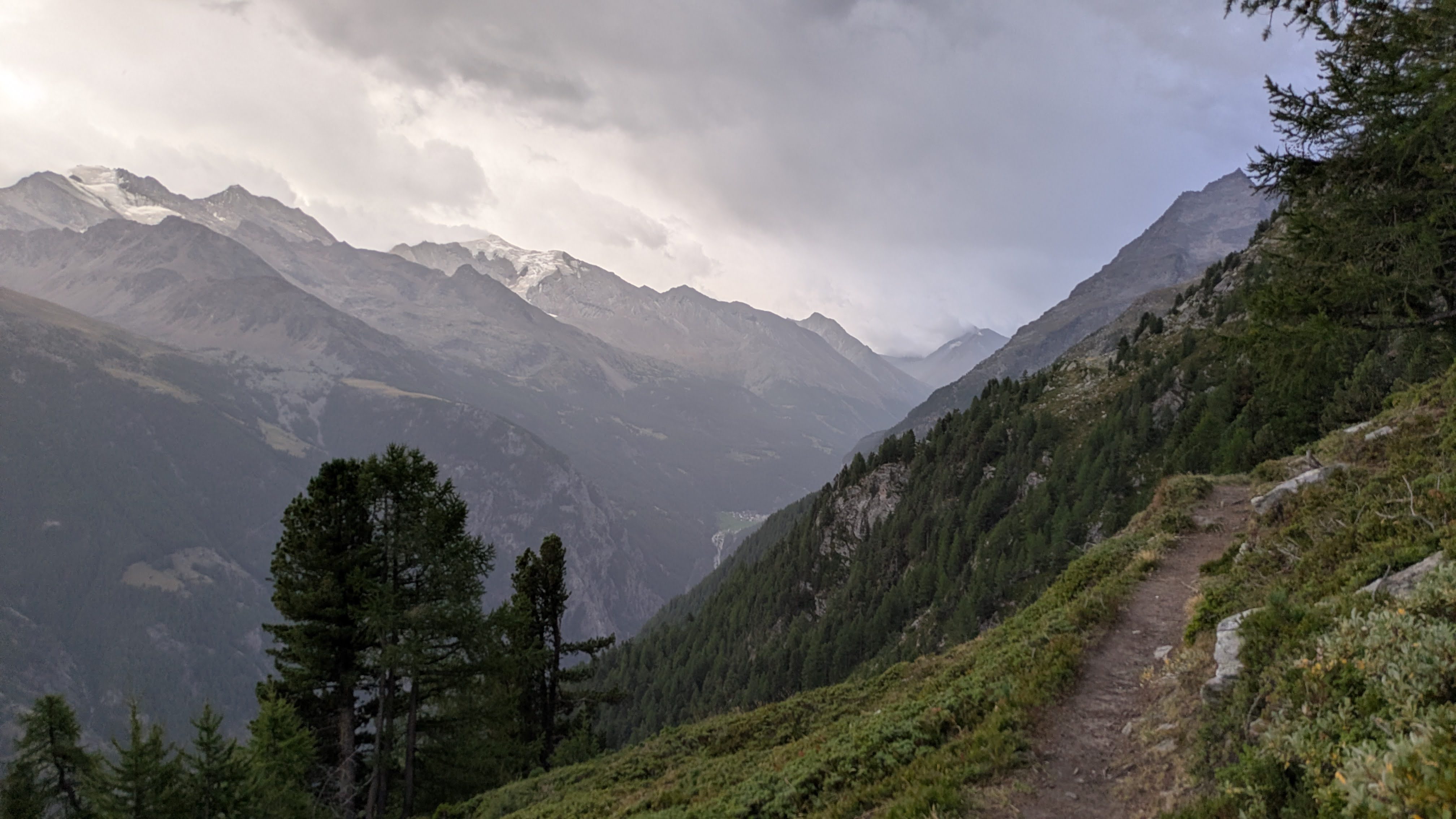
A bit further, after the Hannigalp plateau, I turn into the Saastal, which I will run to it’s south end: Passo di Monte Moro. This part of the TMR should be relatively easy (on paper): a balcony way until deep into the Saastal, to the foot of the climb towards the pass. Reality differs from what it seems on paper. Even though not steep, the path goes up and down almost the whole time. The underground is often not runnable, with rocks and tree roots making it hard to keep a running pace. Every now and then the path is very narrow. And on a couple of occasions I have to cross the results of a rock slide.
But it is a beautiful place for sure! I have a constant view of the peaks and glaciers on the other side of the valley, places I don’t know by name. I spot lots of wildlife: ibex, chamois, squirrels between the trees and groundhogs on the grassy slopes, and a plethora of different kinds of birds, including a bigger bird of prey. Unfortunately, they are all to fast for me to photograph. By the time I have my phone out, they are gone.
09:45 In the descent approaching Saas-Fee, I stop to put on my rain jacket.
The forecast was rain starting around noon and it would keep raining for the rest of the day, well into the night.
It appears the forecast is correct, albeit not very precise.
This is to be expected in the mountains.
Part of the 8.5kg backpack I am wearing is clothes to face all kinds of possible weather I would encounter on this 3 day trip, including rain gear.
In Saas-Fee, I use the local store to resupply on snacks and an apple. I fill my bottles on the village square fountain, and continue downwards to Saas-Almagel, at the foot of the next big climb. The peaks and glaciers above me are shrouded in rain clouds.
12:05 The path leading to Mattmark and it’s Stausee abruptly ends in a patch of thick overgrown bushes.
I try to find my way through, but to no avail.
Luckily, I spot another way up.
When I get to this alternative path, there’s even a signpost to Passo di Monte Moro there.
So this must have become the official path.
Along the lake, there’s a cold wind blowing down from the pass ahead of me. In the lee side of a big rock, I stop and put on an extra layer.
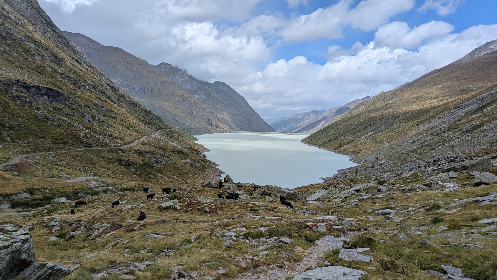
The climb from the lake to the pass is 3.5km, having 600m of EG and takes me about 1h15 of relentless hiking. It rains constantly. Parts of the path are just rocks and I have to scramble using my hands now and then. But I am enjoying this immensely.
14:15 Passo di Monte Moro (2845m).
The first of 5 passes on this route is done.
The view is non existing: I can barely see further than a couple of hundred meters in the clouds.
I spot the outline of the Madonna statue to my right.
A bit lower sits the Rifugio Oberto Maroli. I stop for a cup of coffee and to shelter from the rain. I chat with some hikers in the hut. They are hiking TMR in the opposite direction and have spent the previous night here. After climbing to the pass in the rain, they have decided to turn back and to spend the day in the hut.
The descent to Macugnaga goes slower than I had anticipated. The path is narrow, covered in rocks and mud. I don’t see anything of the so famous east side of Monte Rosa. It’s completely gone in the heavy rain clouds.
16:45 Resupply in a very small shop in Macugnaga.
I am now over 2hrs behind on my (ridiculously optimistic) schedule.
I leave the schedule for what it is and decide to continue and see where that brings me.
This doesn’t bother me much.
I send the people at Rifugio Pastore an e-mail that I will not make the evening meal and am still on my way.
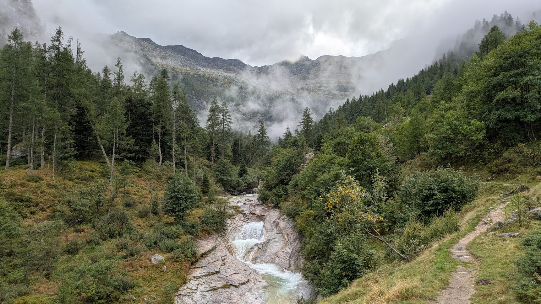
The next pass is Colle di Turlo, about 1500m of EG from Macugnaga. I first have a relatively easy ascent along the stream towards a circus and the end of the small valley. There the path starts to climb steeper in 2 stages with a traverse in the middle. It’s not raining all the time, but I am still wet, both from the rain and sweating beneath my rain jacket.
19:00 This is hard.
Climbing for so long is harder than anything I did in my training.
No amount of hill reps can fully prepare you for the seemingly endless climbs in the mountains.
My legs are suffering and I have trouble keeping up a good climbing pace.
But in my head everything is still fine.
Morale is high: I am continuing and there will be an end to this climb.
Even if there are rain clouds all around me, I still enjoy my surroundings and the views. It is beautiful out here! When the clouds part a bit, I have a glance on the most nearby summit: Corno di Faller.
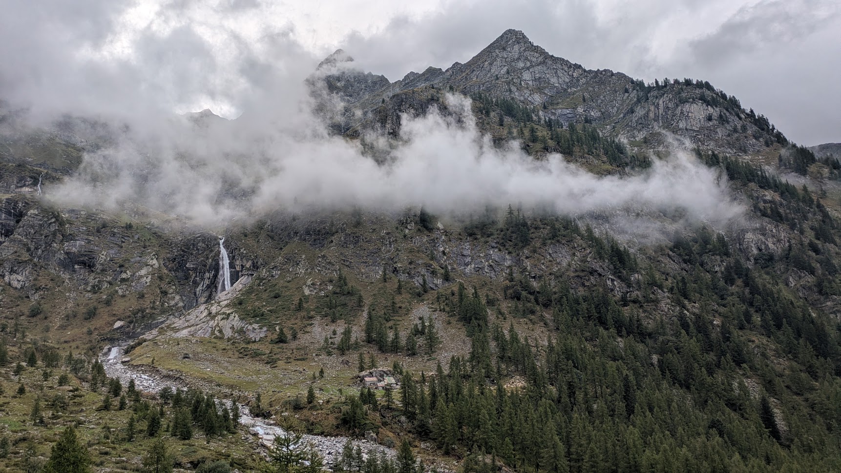
20:25 Lightning! Thunder!
Them being almost at the same time, I realise that it must be very close by.
I am at about 500m of the summit of the climb.
I am a bit afraid.
There’s not much that I can do except continue.
I stay as close to the rock face as possible and continue to the pass.
20:32 Colle di Turlo (2738m).
In the dark, with my head torch on, I start the last descent to the hut.
Some parts of the path are runnable, on others I can hop from rock to rock.
21:49 It still took me over an hour and a quarter to cover the last 7km of the day.
The hut guard was waiting for me.
They haven’t received my e-mail, as that goes to the office in the valley.
Time for a cheese and bacon sandwich, a cold shower and sleep!
| planned | real | |
|---|---|---|
| distance | 54km | 35.96km |
| elevation gain | 4405m | 2855m |
| time | 12h07 | 9h31 |
06:15 Good morning!
And what a morning it is.
Gone are the clouds and the rain.
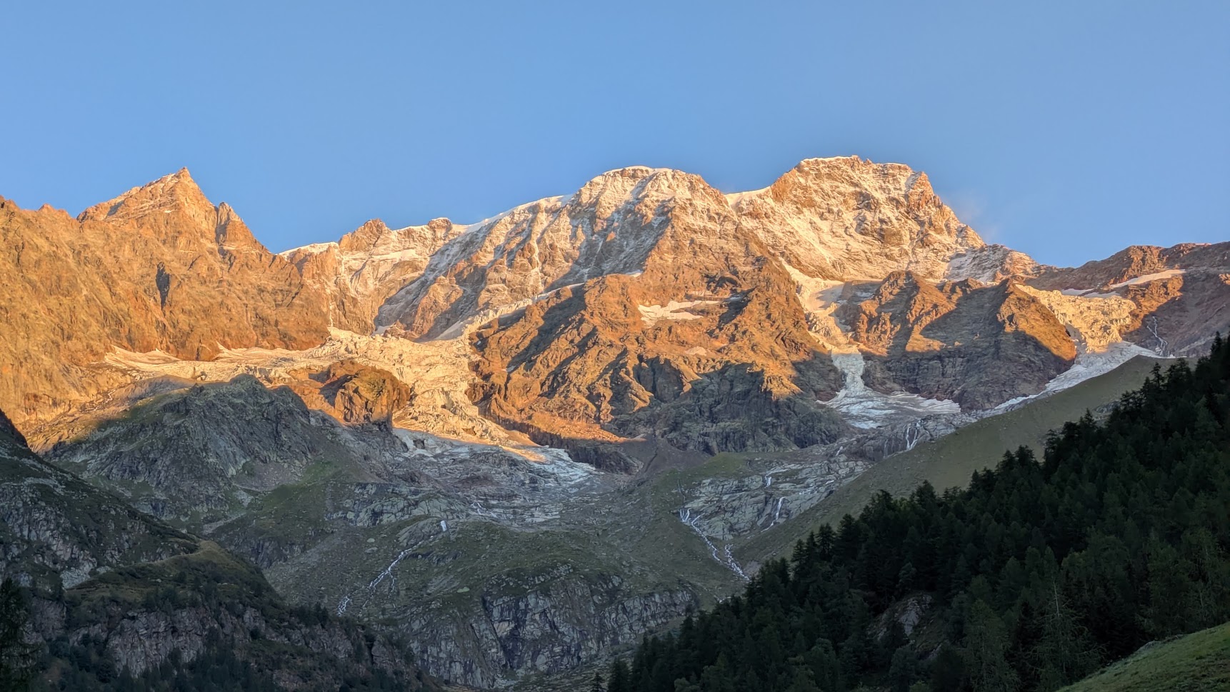
Looking back towards the pass I climbed yesterday evening, I have a great view of some of the Monte Rosa peaks in the rising sun (from left to right): Piramide Vincent, Corno Nero, Parrotspitze, Signalkuppe.
What a view! 🤩
Breakfast isn’t until 07:00. I take my time to repack my backpack. None of the clothes I hung to dry yesterday evening are actually dry. Donning my damp and wet clothes wakes me completely. My only luxury is a pair of fresh, dry socks.
Breakfast in the hut and it’s time to hit the trails again. In Alagna Valsesia there are a lot of runners about. There seems to be a trail running race today. One of the races follows the same path as me. This makes navigating a bit easier. This part of the TMR is not always very well marked.
09:23 I realize that I am running in a wrong direction.
There have been a series of small switch backs before, and my watch doesn’t like those.
It will always indicate that I am off course in such situations.
Which means I didn’t get a warning when I was truly off course.
I had mindlessly followed the small flags of the race.
I am about 2km off course, on a path in western direction.
With the help of Organic Maps, I quickly plot a new course that should bring me back on track. Hurray for apps that work offline!
En route to Col d’Olen, I pass through an alpine village that could very well have been the one from Le Otto Montagne from P. Cognetti.
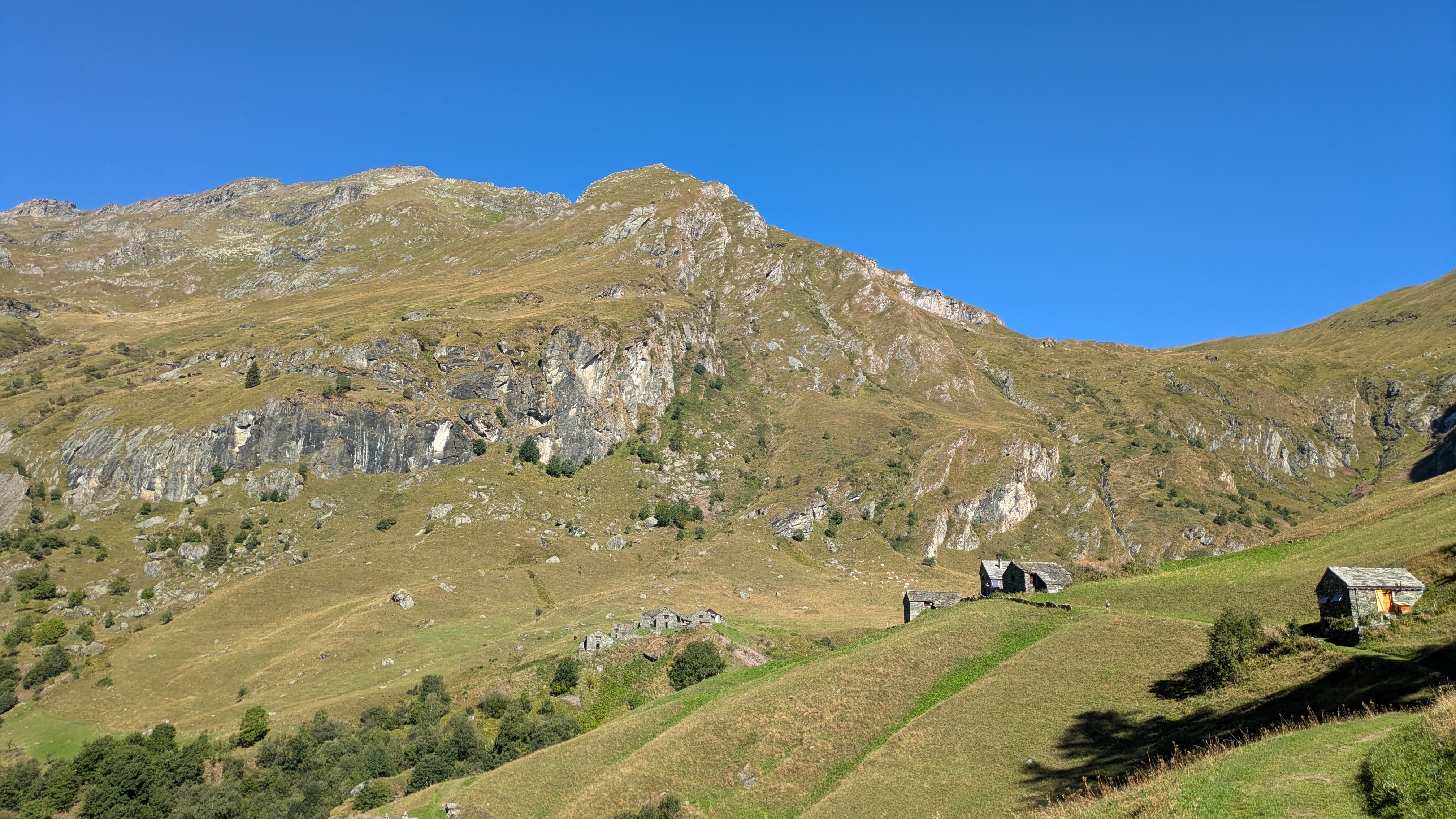
12:07 Col d’Olen (2880m).
That was the first of 3 passes of the day.
By crossing this pass, I am now no longer in Piemonte, but in Valle d’Aosta.
Time for some rest, while I charge my watch a bit and eat bread with cheese and sausages.
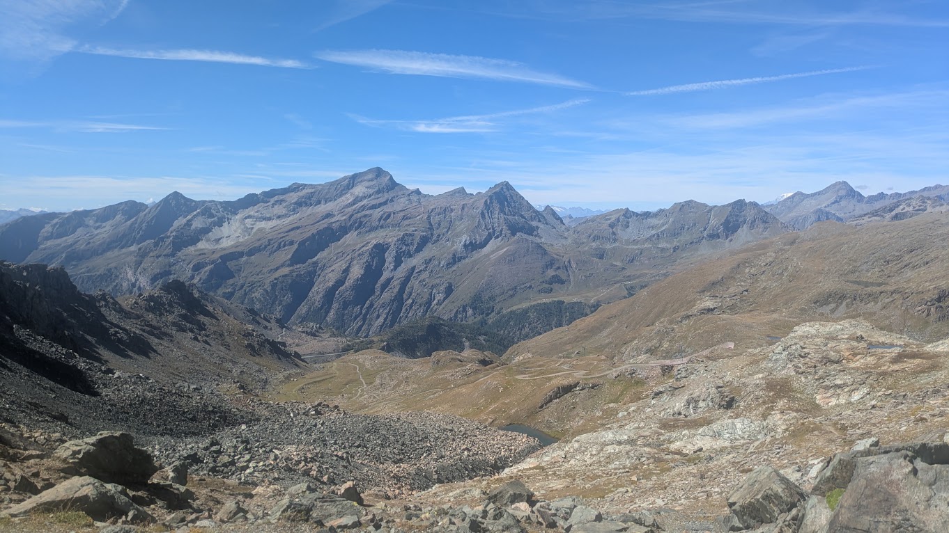
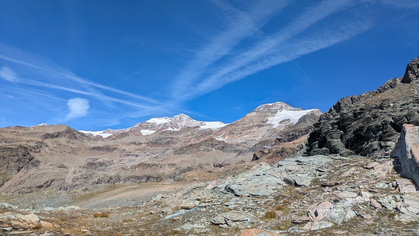
Here are the views from the pass:
East: Piemonte
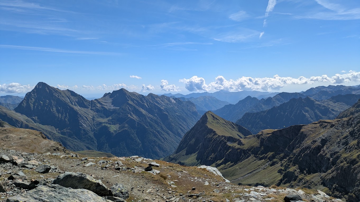
West: Valle d’Aosta
North: peaks and glaciers of Monte Rosa: Liskamm Ostgipfel and Piramid Vincente
12:54 I open my backpack to tuck away an extra layer I was still wearing.
I see now that my head torch, which is on a pocket at the back, is on!
I must have accidentally turned it on when reaching for something.
I don’t know how long it has been on now, how much battery it has left.
To save weight, I didn’t take a spare battery with me, nor did I bring the right cable to charge it.
In my plan, I was hardly going to run in the dark.
This might be a problem this evening.
13:47 I am in Staffal.
The shop where I wanted to resupply is closed until 15:00.
But there is a food truck (actually a container) offering hamburgers with fries.
I quickly decide that a hot meal would also give me the needed calories to carry on.
While eating, it becomes clear to me that it will be late this evening before I arrive at my planned stop in the Gandegghütte. I had messaged them earlier that I would not make the evening meal (18:00), but would arrive rather around 20:00. But now it looks like this would rather become 22:00. Apart from the fact that they weren’t happy at the hut when I announced my late arrival, there is another element that starts to trouble me. Just before arriving at the Gandegghütte, I will have to cross the Theodulgletscher. As I have asserted the remainder of today’s route, I would most likely have to do this crossing in the dark. This doesn’t sound like a good idea. I start to think of alternative solutions.
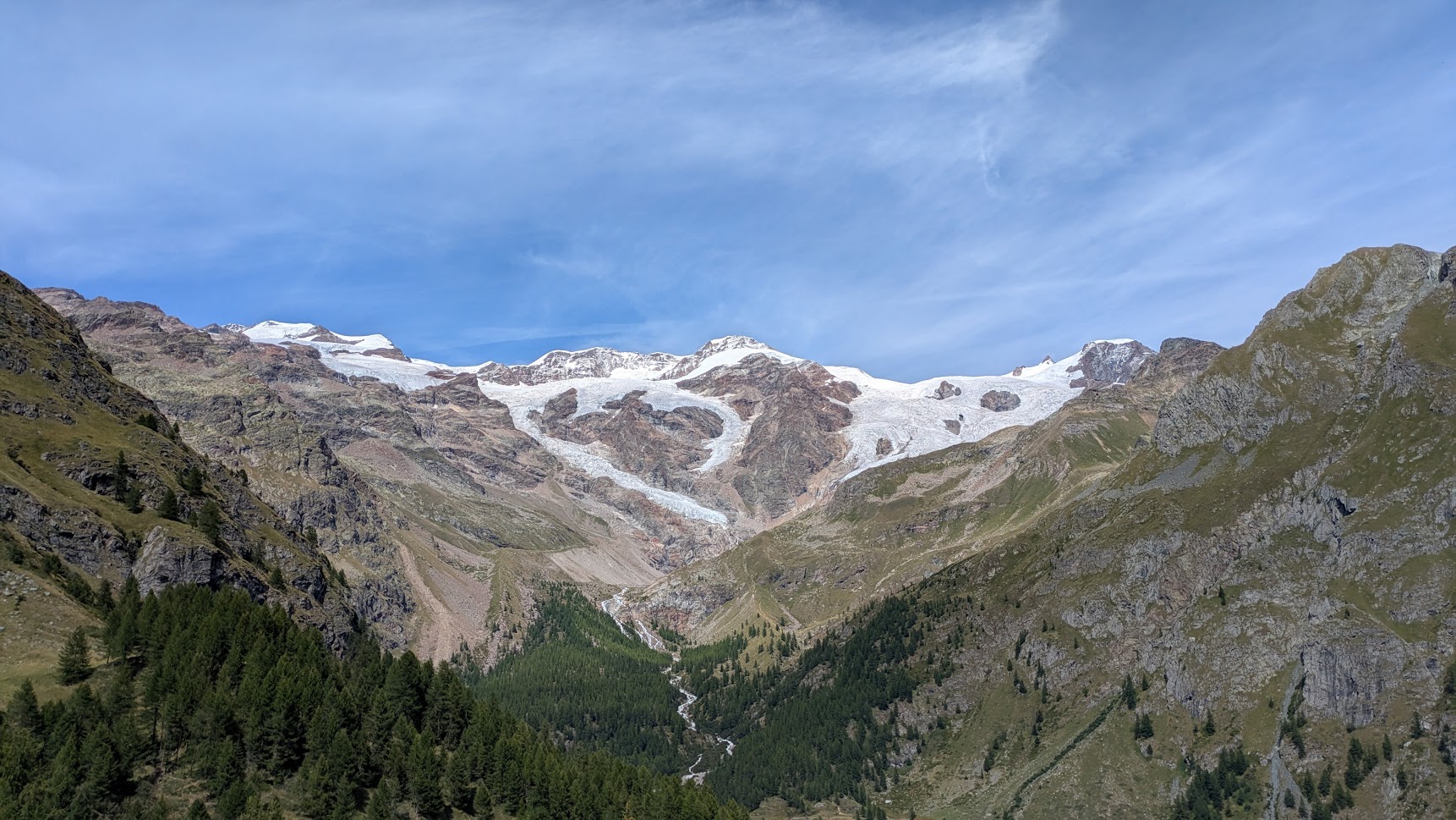
Meanwhile, it’s time to get going again. Staffal being at the bottom of this valley, the only way forward is up. While I am climbing towards Colle de Rothorn, I have a splendid view of the Liskamm peaks (Westgipfel and Ostgipfel) and the glaciers in front of them.
15:50 Colle de Rothorn (2689m). Finally!
This climb in the midday sun was a tough one for me.
I am glad I am on the pass and can start descending again.
During the climb, a plan started crystallizing in my mind. In Resy, near the bottom of this descent, there are 2 huts. Apart from the Rifugio Teodulo on the Italian side of the Theodulgletscher, this is the only other sleeping possibility. I had first planned to stay at Teodulo, but I couldn’t book a night: the hut was fully booked. I will stop at Resy and ask the huts there if they have a free bed. With this problem (almost) out of the way, I can once again fully enjoy my surroundings while running and hiking down the mountain slopes.
17:14 There is a bed for me in Rifugio Guide di Frachey in Resy.
Evening meal is at 19:30, which leaves me with enough time to take a hot shower, hang out all my moist clothes to dry and take a nap.
Today was a shorter day, and I now have plenty of time to refuel and recharge for tomorrow.
I also ask around if somebody has a USB cable with a micro-USB terminal.
And yes, I am lucky: I can recharge my head torch!
19:30 At the communal evening meal in the hut, I share a table with two couples who are also hiking the Tour Monte Rosa.
We share stories about some of the passages and about how we lived them.
This is fun.
They also think me completely crazy to want to finish this in 3 days. 😬
| planned | real | |
|---|---|---|
| distance | 54km | 74.36km |
| elevation gain | 3452m | 4367m |
| time | 10h50 | 16h54 |
Today is going to be a long day. I had arranged a way to have an early breakfast with one of the hut caretakers the evening before. She even explained me how to operate the espresso machine.
05:14 I’m on my way.
It’s still dark, but luckily my head torch battery has a full charge.
After a short descent towards the bottom of this valley, the big climb of the day starts: towards Theodulpass.
It doesn’t take long before I’m out from between the trees.
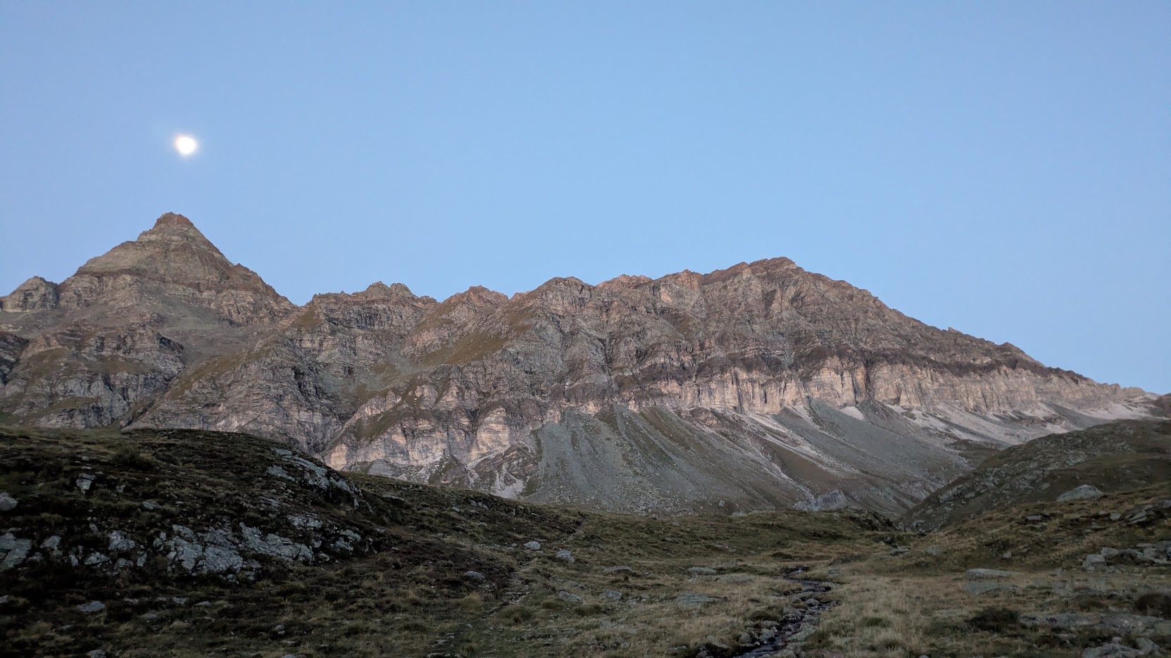
06:21 On the alpine pastures, with the full moon, there’s enough light to stow away my head torch.
I have a beautiful view of Mont Roisetta (Punta Nord) and the ridge that extends north of it, with the full moon just above the peak.
I like to be out here at this time of the day.
I encounter a big flock of sheep, sleeping or grazing, very close to the path I am using. They are guarded by no less than 5 Patous des Pyrenées. As soon as one of them spots me, they run towards me and start barking. They stay close to their flock. But still, they are big and wildly intimidating. I give them and their flock a wide berth.
A bit further, where the climb flattens lightly to a small plateau, there is a camper van. Here, in the middle of the mountains, without any roads or tracks leading here. A guy is standing on it’s doorstep, drinking something hot. We wave to each other and I yell “Bongiorno”.
07:51 Colle Superiore del Cime Bianchi (2982m).
Climbing on to this saddle leads me onto the ski resort grounds on the Italian side of the Theodulpass.
From here until Trockener Steck, I will run/hike between cable lifts and over bulldozed slopes.
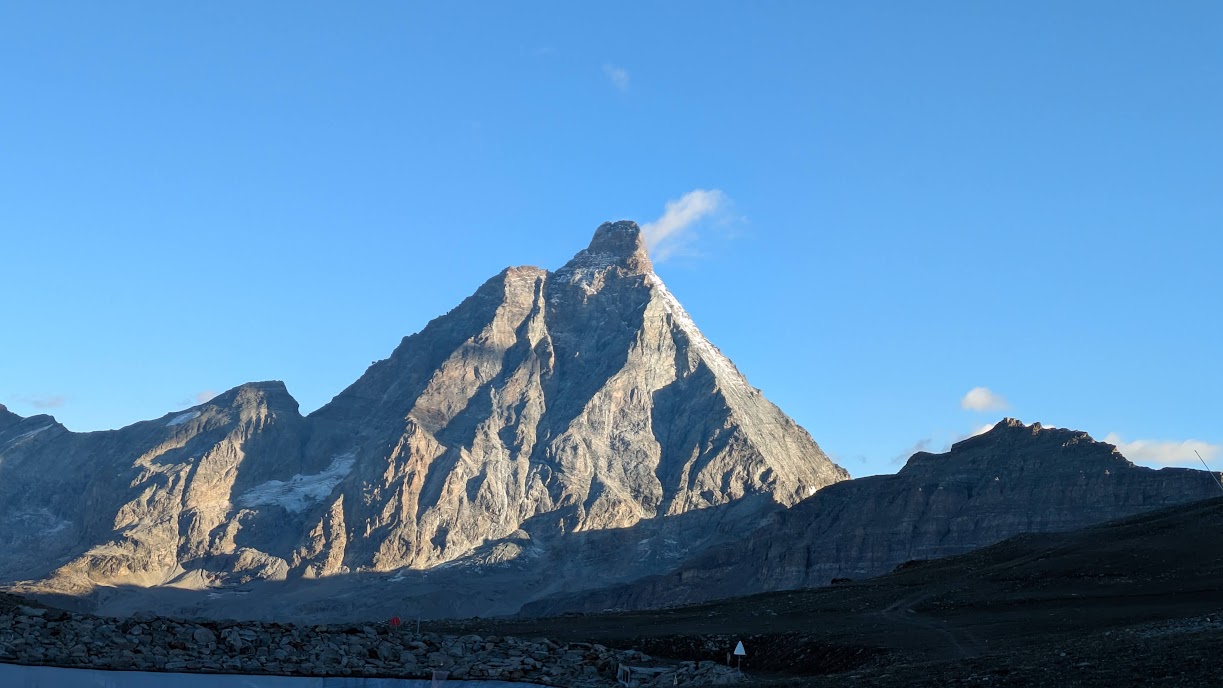
On the upside: I have my first close by view of the Matterhorn!
09:22 Theodulpass (3298m).
I am at the highest point of this whole trip.
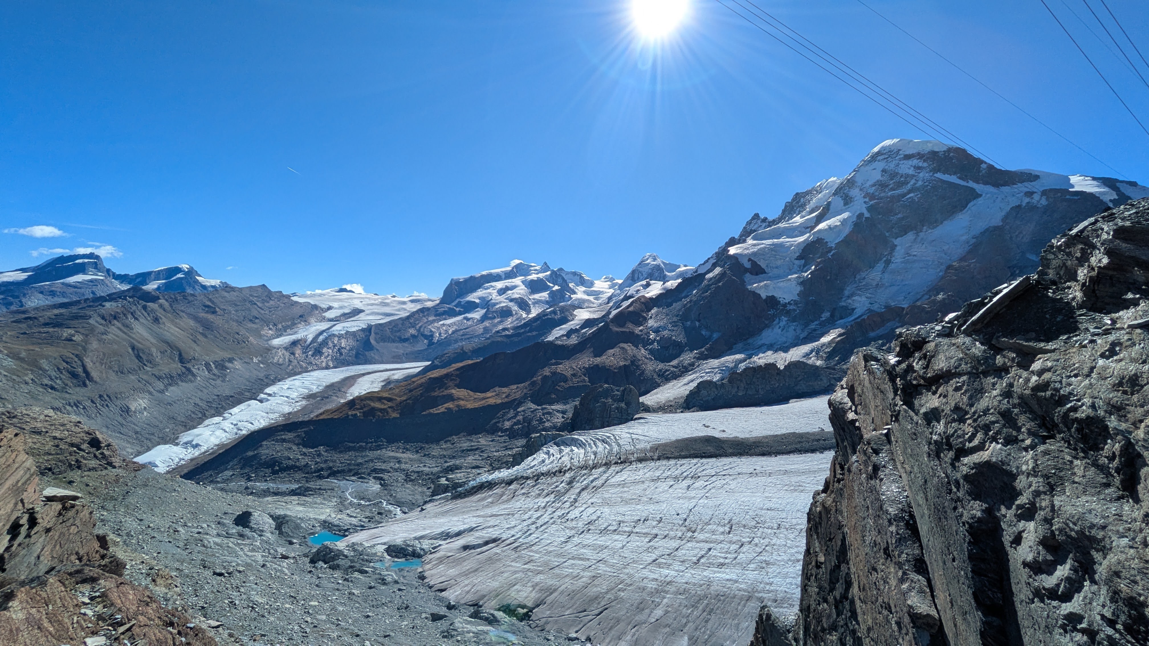
Italy lays behind me, and in front of me is the Theodulgletscher, which I will have to cross now.
This is by far the most exciting part of the trip for me.
A worked ski piste is clearly visible ahead of me.
I know that I will be able to follow this piste for the biggest part of the glacier crossing.
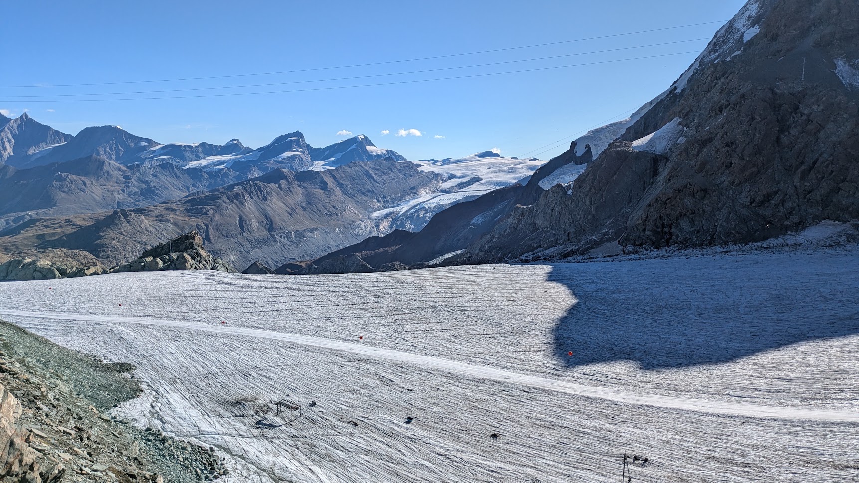
First I have to get there, but from my vantage point higher on the rocks, I see where I am going to run. I plot a way down from the rocks towards the glacier. Arriving near the ice, I put on my nanospikes and am ready to go. It’s beautiful!
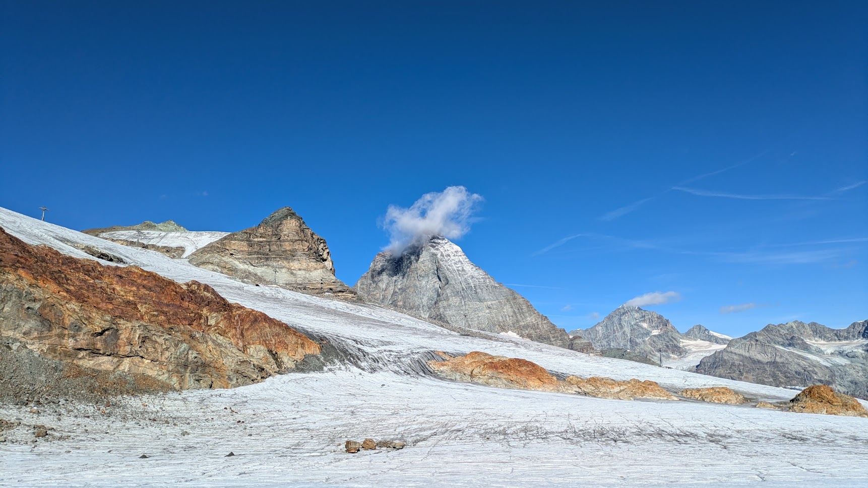
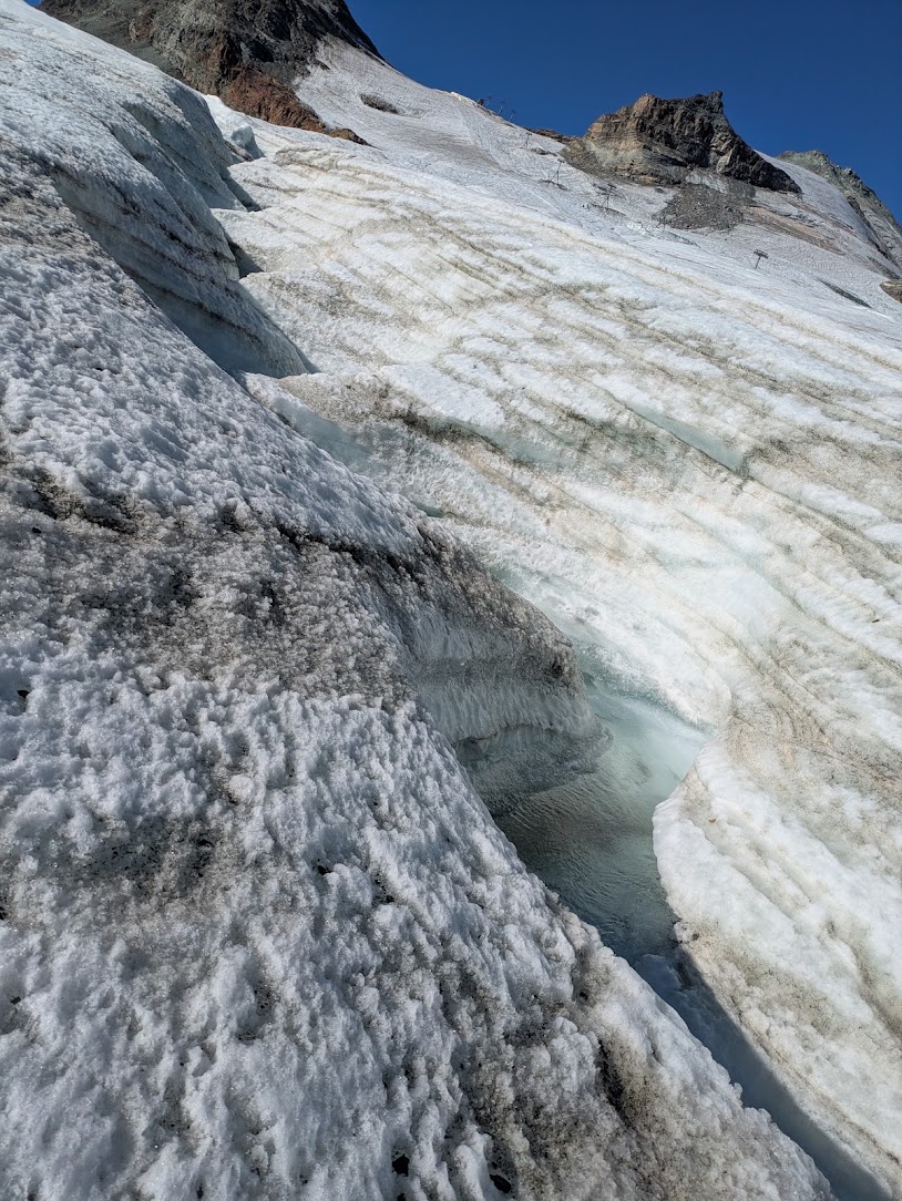
Near where, according to the GPX track, I should get off the glacier, the icy terrain is very rough and crisscrossed with crevasses. I decide to descent a little more, to a spot where this ski piste I am on is closer to the rocks and where the remaining glacier part is relatively flat. Beneath a nearby crevasse I hear running water.
I have to scramble over a slope full of boulders to get back to the path. Once I am there it’s downhill to Zermatt. In the Gandeghütte, I try to get some water, but they don’t want to give me any. They only want to sell me bottled water at 6,- CHF per 500ml. No thanks.
11:12 I left the last cable car pylons behind me and am steadily descending.
The path is mostly runnable.
I can maintain a good pace.
I the hamlet of Zum See, I look around and find a water fountain where I drink and refill my bottles.
Those have been empty for some time now.
12:34 Zermatt: I resupply in a supermarket and take some time to sit down, eat and drink, recharge my watch, and write a status message on Ferrett.
I still have over 40km, with 2 bigger climbs, ahead of me.
I am feeling strong, my legs are tired but nothing really hurts.
The sun is shining.
Time to get going again!
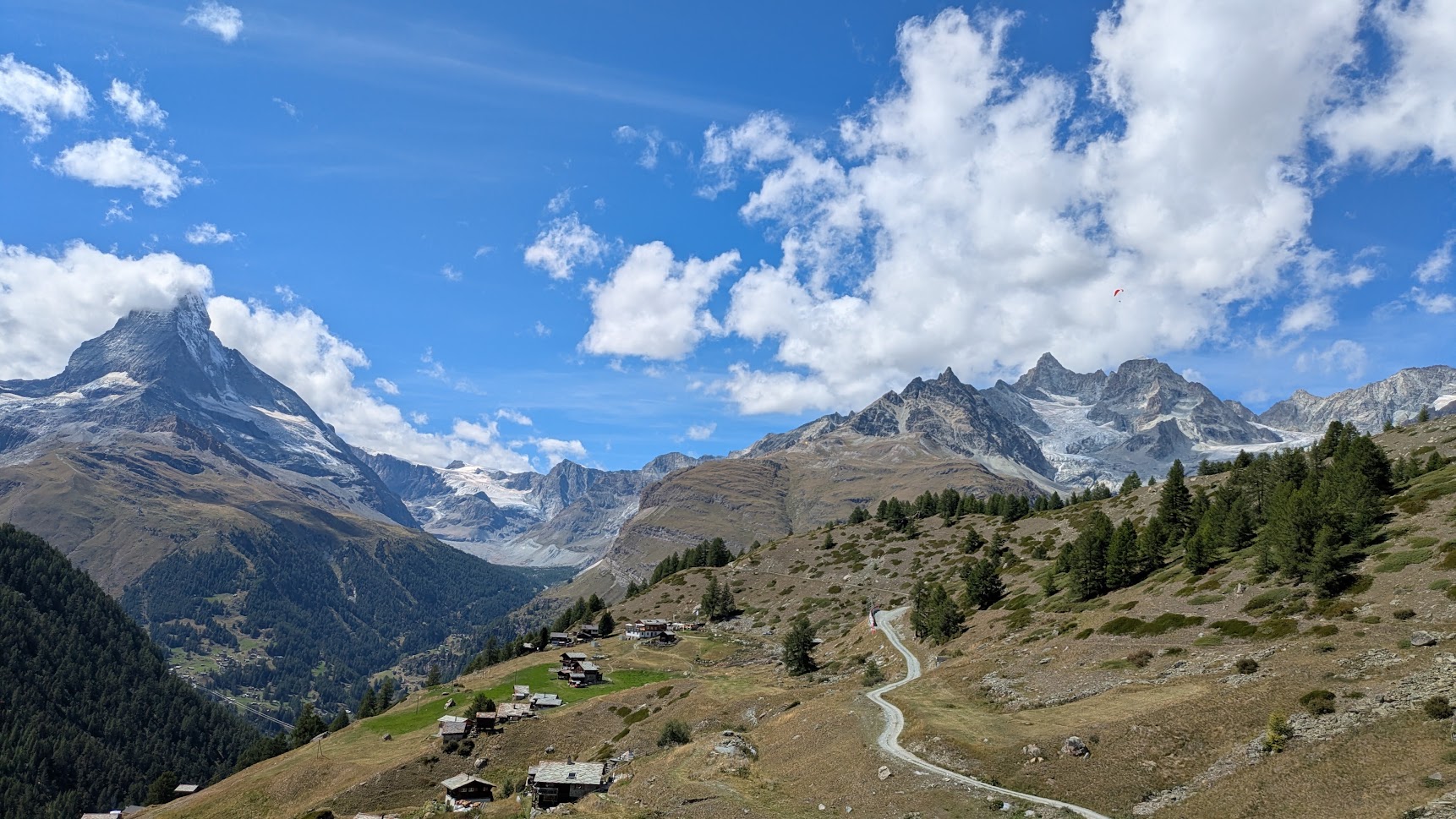
I leave Zermatt and start the first of the 2 last bigger climbs of the day, into the valley of the Findelbach. At the top of the climb, near Sunnega, I have a beautiful view looking back towards the Matterhorn and Zinal Rothorn.
From here on the path follows the Mattertal, horizontally on the slopes. It’s not flat running, but the ups and downs are shorter and less steep. Sometimes the path is broader and very much runnable. Sometimes the terrain is difficult, with boulders or rocks or tree roots. But all in all I move good.
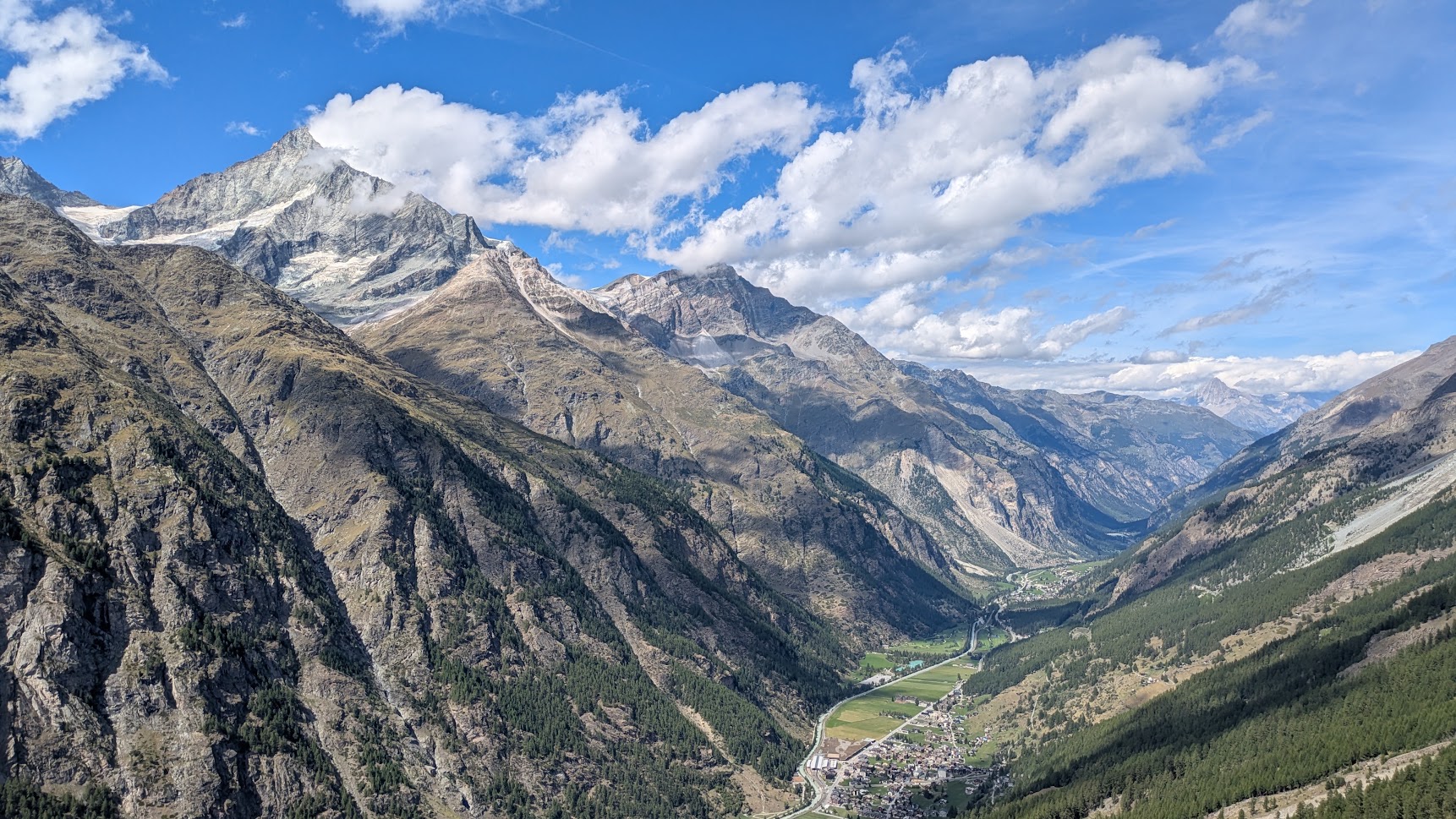
15:21 In Täschalp, I have to make a detour.
This part of the TMR, and the Europaweg, between Täschalp and the Wildibach stream is inaccessible due to rock slides a couple of years ago.
My detour goes down to Täsch.
There I will follow the Mattertal at the bottom of the valley until Attermänzen.
And then it’s climbing again to get back onto the Europaweg.
16:07 Time for a couple of minutes of rest in Täsch.
I refill my bottles at the local fountain.
I chat a bit with Mieke.
16:52 The path I had planned to use to climb back up to the Europaweg is blocked with a sign: rock slide.
Luckily there is another path I can take.
This will shorten my course a bit, not that I care much.
17:51 I am on the Charles Kuonen Hängebrücke.
Wow!
I had anticipated that this would be a great bridge to cross.
And I am not disappointed.
The suspension bridge is 495m long and spans a rockslide on the mountain slope.
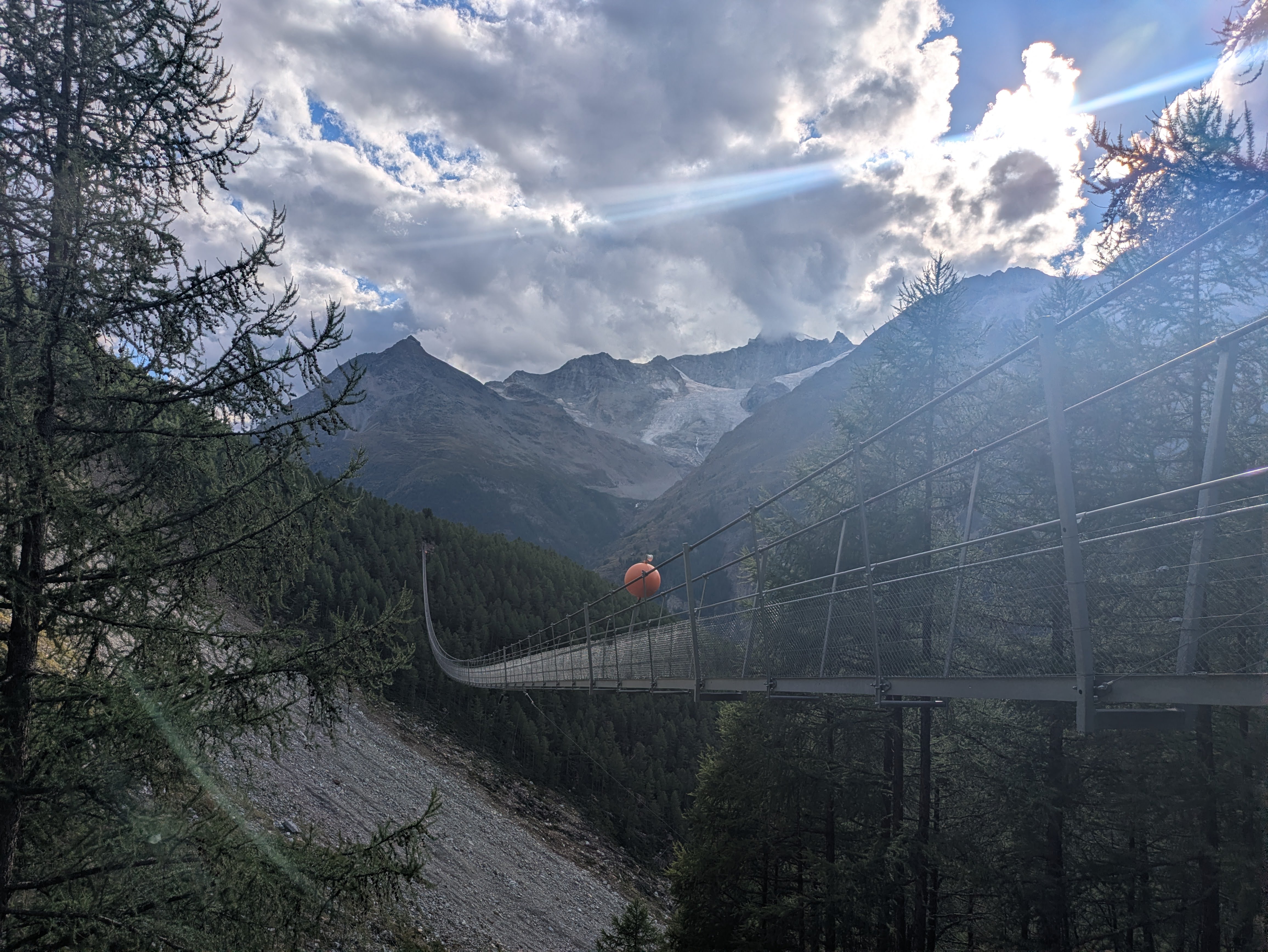
On the other side of the bridge, I stop at the Europahütte. I have drunk a lot of water in this last climb. I can refill my bottles, but have to pay for the water. As I don’t see an immediate alternative, I pay the 4,- CHF for 1L of water.
19:46 In the descent towards Herbriggen, I meet an older lady, hiking in the opposite direction.
She asks me something in Switzerdeutsch of which I didn’t understand a word.
We switch to English, and have a nice chat.
Her family has an alp house higher up the mountain.
There is a garden with flowers and vegetables.
She goes up there from Herbriggen, where she lives, every second or third day to tend the garden and water the plant beds.
We wish each other a good evening and get back to running (me) and hiking (she).
A nice encounter.
20:03 A last good climb out of Herbriggen and that’s it for climbing today.
Between the trees it’s getting to dark: time for my head torch.
21:30 My water bottles are empty.
I am almost there, so that shouldn’t be a big problem.
But I am thirsty the whole time.
I suspect I haven’t been drinking enough today, especially this afternoon.
No water fountains in the Gasenried hamlet.
Just at the entrance of Grächen there is a fountain. Even if I know there’s less than 1km to go, I stop to drink. I am so thirsty!
22:08 I see Mieke standing in the middle of the road.
This is my finish line.
I did it! 💪
This was just great! At no point was I ever in doubt about finishing this tour. Yes, it was hard sometimes, especially the long climbs. And I underestimated the time those technical descents would take me, which messed up my schedule right from the start. But my legs were strong all through this trip. I guess all this extra strength training payed off somehow.
What an adventure. I enjoyed every minute of it. I want to do this kind of adventures again!
And so many beautiful views.
If you want to react to this post, you can contact me: